Avian-Solar Interactions Symposium (Part 1)
October 26, 2017 - Sacramento CA - Basin and Range Watch attended the August 16 Technical Symposium on Avian-Solar Interactions in Sacramento CA, organized by the Multiagency Collaborative Working Group. Sandra Brewer of Bureau of Land Management (BLM) and Amedee Brickey of the US Fish and Wildlife Service gave introductions. Karen Smith of Argonne National Laboratory gave a review.
In addition, the solar industry based group, Avian Solar Working Group gave an introduction: Jodie Gless of NextEra Energy, and Aimee Delach of Defenders of Wildlife.
Overview of Avian-Solar Interactions
Although we beleive these numbers are low, we report on Wally Erickson of WEST, Inc., who gave a talk summarizing some current avian mortality numbers in California and Nevada for Desert Sunlight Solar Farm, Blythe Solar Energy Project, McCoy Solar Project, Silver State South Solar Farm (in Nevada), and California Valley Solar Ranch. A standardized approach to searching for dead carcasses was used, so that 20-45% of the solar arrays were searched, and rows were walked. 25-100% of chainlink fences were driven and searched. We were not clear how often searches were conducted, but Erickson said that for Desert Sunlight Solar Farm the solar field was searched 2, 3, or 4 days per week.
Carcass persistence trials were done, searcher efficiency trials were done, game cameras were set up, and estimators for missing carcasses were run. Although scavengers such as ravens began to learn to follow surveyors.
Very few bats were found--one at the McCoy Solar Project along the Colorado River was picked up.
At California Valley Solar ranch in Carrizo Plain, Kern County CA, most common deaths were mourning doves (202), horned larks (99), western meadowlarks (31), and burrowing owls (7) were found dead in a little over one year. It was difficult to tell if the deaths were due to collision or other causes.
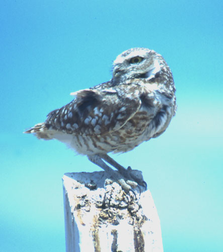
^Burrowing owl.
More raptors were killed at Silver State South project in Clark County, southern Nevada.
At Desert Sunlight Solar Farm in Chuckwalla Valley, Riverside County CA, 26 grebes were killed, and 18 coots. There were few signs of collision, and apparently these waterbirds landed and could not take off with water. Erickson said the "lake effect" of the solar fields needed more study.
A per-megawatt per year metric was fatality rate was estimated, similar to wind projects, and California Valley Solar ranch and Desert Sunlight Solar Farm were found to have the highest rates (highest in Fall at Desert Sunlight).
Mortality at the chainlink fences was found, and it was unclear if some birds walked over from the solar array to the fence and perished later. Some roadrunners were found dead at the fenceline.
Possible factors affecting avian mortality were location and size of projects, and nearby features.
Effects of Renewable Energy Development on Wildlife
Todd Katzner of USGS gave an interesting talk on the need for better standardization of mortality data collected across the desert projects. Are pre- and post-construction surveys changing methods over time? How often are facilities using rigorous study designs and reference sites?
Corrections in bias, such as searcher efficiency, carcass persistence, and detection probabilities, are not being used at every solar project.
Only two projects (California Valley Solar ranch and Genesis Solar Energy Project) carried out both pre- and post-construction surveys. Only 15.6% of surveys used a before/after reference site. Not all surveys used the same methods--some used point counts and others did not. Only 6% of wind and solar projects estimated detection probability.
So with these data gaps and scientific shortcomings, Katzner said it was difficult to assess the ecological effects of renewable energy development.
Another ongoing problem was scientist access to data collected.
Very few pre-construction surveys showed mortality, interestingly. And pre-construction surveys were not detecting some species that were found in later mortality surveys, such as grebes--are solar projects attracting some species? Katzner said this is a big question.
Phalaropes have been killed on solar projects, and one white pelican. House finches and mourning doves are killed in large numbers. Habitat for Swainson's hawks has been removed by solar projects.
The goal of these surveys should be to better understand population level effects.
Resident Roadrunners have low numbers in a local population, but many have been found dead on solar projects. How much of the local population is being killed? Killing 1% of the roadrunners is not a large impact, but what if 50% of roadrunners in a valley are being killed? That is big.
Western grebes seem to be long-distance migrants. An estimate of the catchment area can be made, then build population models, then mitigation measures can be decided upon. Stable isotope analysis of feathers can be done to discover the spatial extent of populations, from known samples. Are birds killed at a solar project flying in from Idaho or Mexico?
Demographic models can be made. At the Altamount Pass wind area, for instance, in one study 17 or 66 golden eagles killed at wind turbines were non-local, and 30% were second-year birds. This means the local population is only being sustained by 2-4-year-old birds immigrating in, not by breeders. The area is a population sink.
Background Avian Mortality in the California Desert
Amy Fesnock of BLM gave a very interesting talk on her background avian mortality study. BLM decided to piggy-back avian mortality surveys onto desert tortoise line distance sampling, which has a long history of annually counting tortoises for recovery estimates, across the desert in a rigorous scientific fashion.
Those familiar with Agassiz desert tortoise biology know that line distance sampling has been used since 2001. A 12 kilometer-square transect is walked by trained surveyors who look for tortoises and record the perpendicular distance of tortoises to the transect line. Transects are randomly placed in desert tortoise conservation management areas.
US Fish and Wildlife Service describes line distance sampling for tortoises:
In order to demonstrate that tortoise populations are recovering adequately, it is important to use the best available data from the best available survey methods to describe the long term population trends throughout the Mojave and Colorado deserts. Line distance sampling has been adopted as the best technique by the group of federal, state, and local agency partners that are working toward recovery of the desert tortoise. Distance sampling generates a detection function based on the perpendicular distance of objects (tortoises) from the center of a transect. Since tortoises are cryptic and harder to see the farther they are from a person, the detection function provides a correction for the number of tortoises occurring per kilometer walked along the transect. Because tortoises may also be hidden in burrows or deep bushes, even when close to an observer, further correction is provided by estimating the proportion of tortoises that are visible during the monitoring period. Tortoises equipped with radio transmitters are monitored each day to assess the proportion of encounters when they would be deep in a burrow or thick vegetation and not visible. The encounter rate and the two correction factors provide an estimate of the overall population density within each monitoring area
Fesnock came up with a brilliant way to have surveyors also look for any dead birds along these transects, to estimate background avian mortality in more natural areas of the desert, not disturbed by solar development.
Surveyors were trained to find carcasses placed out in the desert, and 97% of detections were within 10 meters of the line. So 10 meters was used as the effective sampling width.
Carcasses were placed out on desert sites to see how log they lasted. USGS Mathematician Manuela Husto applied statistical sampling techniques to the data and applied detection curves for large, medium, and small birds, and was able to estimate when carcasses would no longer be observable.
453 transects were walked by biologists from March to May in 2015, in the Fremont-Kramer Area of Critical Environmental Concern (ACEC), Superior-Cronese ACEC, Ord-Rodman ACEC, Joshua Tree National Park, the Pinto Mountains, Chuckwalla ACEC, and Chocolate Mountains. So these surveys covered a huge swath of the California Desert with intensive surveys walking the ground searching the ground. Surveyors covered 37 square miles of relatively natural desert.
In all this survey effort, only 6 avian mortalities were found: one adult red-tailed hawk, apparently killed by a great-horned ow,l as it lay below an owl nest; one juvenile red-tailed hawk; one rock wren that was apparently predated by a loggerhead shrike, as it was preserved on a shrike perch impaled on a cactus; and three feather spots of unknown species.
This is far, far less than the avian mortality rate on solar projects. Some solar companies have implied that their bird mortality rate is not much greater than the natural background mortality rate in the desert, as before a project broke ground. But Fesnock's study refutes this strongly.
The desert background mortality rate determined from line distance sampling in 2015 was 0.024 birds/acre/year. This could be broken down further to 0.004 large birds/acre/year, 0.0026 medium-sized birds/acre/year, and 0.0214 small birds/acre/year.
But on three unnamed solar projects, Fesnock explained that the avian mortality rate increased to 1.7 birds/acre/year, 0.4 birds/acre/year, and 0.6 birds/acre/year.
Fesnock concluded, "When compared to mortality rates from solar projects, background mortality does not appear to be a significant factor and could easily be accounted in the sampling design error rates."
Thus solar fields seem to be killing birds at a higher rate than normal in desert natural communities.
Stay tuned for another article (Part 2) of more interesting presentations at this Sacramento Avian-Solar Interactions symposium. We are only half-way through describing and commenting on the research. Ivanpah Solar Electric Generating System studies are in the next session.
Multiagency Avian-Solar Interactions Workshop
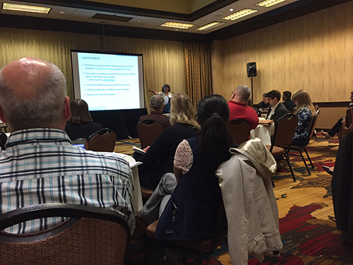
May 26, 2016 - Sacramento CA - We hear a lot of comments that say, why care about birds dying in solar flux at power towers or colliding with photovoltaic panels in large-scale projects out in the desert, thinking they are lakes, why bother? The argument goes, so many more birds die from collisions with buildings or vehicles on highways, or are caught by domestic cats. Yet cumulative impacts should not be ignored -- why add even more sources of bird mortality? And importantly, largescale solar and wind projects are often placed in remote wildland habitats that do not have high mortality rates from structures or urban effects. Associated transmission lines add sources of mortality and disturbance. Species of birds such as golden eagle, which are not killed by domestic cats, are at risk from these largescale renewable energy projects. Many government agencies are concerned with avian mortality at solar projects, and this workshop focused on this.
About 70 people attended the Multiagency Avian-Solar Collaborative Working Group meeting, many from industry and government to discuss the issues. Only a few non-governmental organizations were present, including Basin & Range Watch. Following are summaries of each presentation and our commentary.
Some of those present included: Department of Energy, National Renewable Energy Laboratory, California Energy Commission, US Fish and Wildlife Service, Greg Helseth of the Las Vegas (Nevada) Field Office of Bureau of Land Management, Brian Novasak of the wildlife section of Bureau of Land Management Washington DC office, Argonne National Laboratory, United States Geological Survey, Nevada Department of Wildlife, California Department of Fish and Wildlife, Arizona Game & Fish Department, Solar Energy Industries Association, Largescale Solar Energy Association, NV Energy, Center for Biological Diversity, NRDC, Defenders of Wildlife, NRG, Iberdrola, First Solar, Recurrent, Solar Reserve, NextEra, EDF Renewable Energy, West, and some Tribes.
Posted on http://blmsolar.anl.gov/program/avian-solar/
Welcome and Overview by Department of Energy -- Sunshot Initiative
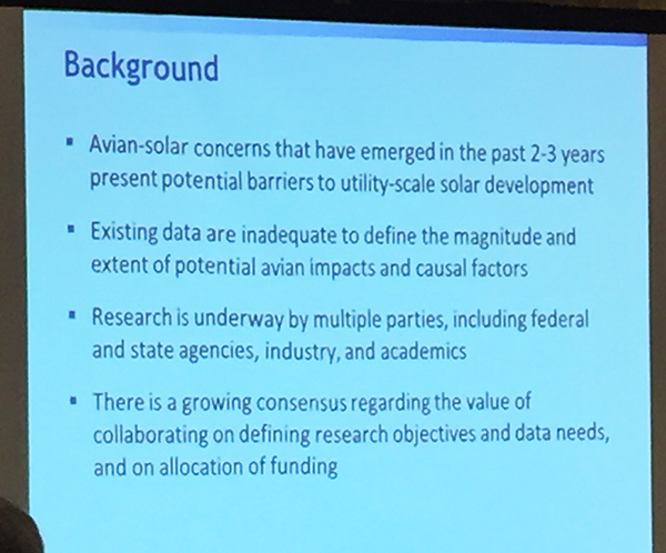
This working group meeting was funded by the Department of Energy Sunshot Initiative, which was started in 2010 to reduce solar costs by 75% in 10 years, to 5-6 cents per kiloWatt-hour without subsidies. Their goal is to achieve a dollar per watt by 2020, and find out how to install terra-watts of solar into grid. Soft costs are being addressed -- such as wildlife issues. Don Boff of DOE said there is a need for good data on these sites. Information asymmetries lead to energy inefficiency and poor decision making, leading to higher costs. Avian issues are "a known unknown" Boff said, so we need more data, plans, and better decisions. Information should be shared between agencies and stakeholders, issues identified.
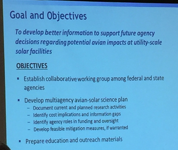
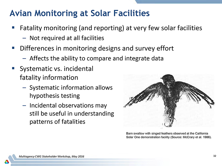
Collaborative Working Group
Greg Helseth, of Las Vegas Nevada BLM, discussed developing feasible mitigation measures to incorporate into Right-of-Way grants so applicants can understand costs. The Collaborative Working Group (CWG) would develop educational materials. An Avian-Solar Science Plan would be developed by October 2016. Stakeholders can comment in writing by June 1. These are like scoping comments. This will help us figure out costs for getting 20,000 megawatts of renewable energy by 2020, he said.
Available Avian Solar Information
Kirk LaGory, ecologist for the Argonne National Laboratory, discussed the Avian-Solar Science Plan being developed and said there was a fair amount of information beginning to be amassed. A conceptual model for how birds and solar interact was presented (see below), showing direct, indirect and cumulative impacts. Information is needed on the location, seasonality, and type of bird being impacted by solar projects. The science plan will include a summary of existing information, information gaps, and present research and monitoring needs which is important. Program implementation costs, adaptive management, and agency roles will be in the plan. As learning occurs changes in management will occur. Guidance will be included for tiering from this plan for agencies. There will be a webinar for the draft plan roll out in June 2016.
We think the conceptual framework is good, and hope the agencies can develop good survey methods to collect data on how solar projects impact birds that can inform and guide avoidance and better mitigation.
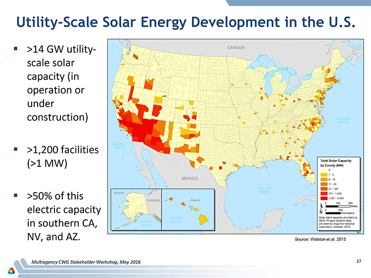
This conceptual framework illustration illicited some questions by solar industry representatives on how flexible it was? Lee Walstin of Argonne Lab drafted it, with comments from the CWG. There are 14 GigaWatts of utility-scale solar projects in the US that have broken ground, and four times that in the queue. There exists a Lake Effect Hypothesis for the attraction of birds to photovoltaic projects, but no studies to address it yet. There are 16 facilities with avian monitoring data that DOE has been using, with both incidental or systematic survey data on bird carcasses. There are avian monitoring plans for most of projects on public lands, none were obtained for private-land projects in the Imperial Valley CA. Fatality monitoring was not required at all sites. Some projects only collected incidental data. Much variation existed, such as with search effort and searcher efficiency, with differences in way those were determined.
Feather Spots
How death spots were handled also varied, as well as predation, scavenging, background mortality -- all were handled differently, not consistent. There is a need decide how to address this, and have a standardized process. There is some work done on heliostat standby aiming to reduce flux levels.
Wind project issues held good comparisons -- scavengers leave a scatter of about 10 feathers, referred to as a feather spot. These are not molted feathers. But there is uncertainty in estimates of how often feather spots occur, and a working definition. We note that in further discussion, feather spots can also occur after a bird collides with a solar panel.
Solar Reserve, however, argued that feather spots could be from a raptor perching and eating a bird it had caught, that causes were unknown. This argument goes against evidence and photographs presented by US Fish and Wildlife Service, and our own observations of birds colliding with glass.
Control sites were suggested as a way to better understand background mortality.
Death spots can have a big presence at a solar project relative to carcasses: two thirds of mortality is identified from feather spots. One solar array had avian remains represented by 97% death spots.
A Question of Good Science
A discussion followed where some contract biologists working for the solar industry said, "we often generate a lot of data but that may not be good to provide publicly, as there could be other hypotheses. What are we trying to answer in a particular site?" Many solar industry representatives wanted to hold avian survey data close and wait to let the public, or even agency scientists, examine it, arguing the data would need careful interpretation. We strongly disagree: science is about collecting raw data, analyzing the data, seeing what patterns arise, and then forming conclusions. The public needs to be allowed to see the data collected on publicly-funded projects that are built on public land, so we may form our own conclusions. Industry interpretations may vary greatly with public and research science interpretations. This is fundamental to the whole Avian Science Plan -- will good science be allowed to inform the plan?
A University of California at Berkeley syllabus on what science is, for example, explains that "Science is a community endeavor. It relies on a system of checks and balances, which helps ensure that science moves in the direction of greater accuracy and understanding. This system is facilitated by diversity within the scientific community, which offers a broad range of perspectives on scientific ideas."
Avian mortality data should not be hoarded by any one entity, company, or agency, but be available for broad dispersal so that true checks and balances can create transparency.
More troubling to the pursuit of accuracy in this science plan, was mention of possible intentional bias in surveys. Ileene Anderson of the Center for Biological Diversity told the audience that they receive numerous calls from field workers reporting they have been instructed to not report bird mortalities. She said the reality is that people feel pressured, and feel they will loose their job if they report dead birds at projects.
Kevin Emmerich of Basin & Range Watch commented that agencies too should be better at making information public and transparent; it has taken a year-long Freedom of Information Act request to get avian mortality data from the Bureau of Land Management concerning the Crescent Dunes Solar Energy Project in Nevada.
USFWS personnel commented that data from wind projects is not shared as much as would be ideal, so it is difficult to develop good monitoring strategies. They asked the solar developers to share information. A clearing house for information could be made.
USGS representatives said they need unbiased estimates. Comparability from site to site is different. An unbiased estimator is required, as there may be different search intensities or a different number of searches per week in projects.
Laura Abram of First Solar said that causation needs research. We agree, but we counter that to make hypotheses about causation, we need more accurate data to analyze. Causation does not come before data collection and analysis, but much later in the scientific process as results are discussed and interpretations are formed. Withholding data is not proper scientific method for any kind of research question. Do the data suggest causation or correlation? In other words, do the data suggest that two factors are correlated with one another or that changes in one actually cause changes in the other? Correlation does not imply causation. This can be very tricky to differentiate with many variables present, causation needing much more evidence to build a strong case. Ideally a lot of statistical analysis of a large data set should go into deciphering how variables relate to each other, or not relate. To repeat: the data should come first and be made public so that good science can happen.
And since the solar industry has certain goals and agendas (to construct solar projects with the least cost) we do not believe they are necessarily the best entity to carry out objective research in avian mortality. Third party data collectors and outside research entities would increase transparency and accuracy.
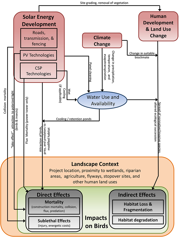
^Conceptual model for how birds are impacted by utility-scale solar projects.
Avian Mortality Studies at Largescale Solar Projects
Tom Dietsch of US Fish and Wildlife Service gave the most complete and we feel the most accurate presentation on available avian mortality at solar projects so far. A high proportion of hummingbirds have been found killed by solar flux. Most birds are insectivores. There may be a lake effect that attracts birds -- mirrors or photovoltaic panels appearing like a body of water. Many bird species of regional concern may be at risk. Long distance migrant population level effects may be hard to determine. There needs to be robust monitoring (we could not agree more). There also needs to be migratory pathway and migratory connectivity research; genotyping and telemetry are a few methods being used by researchers at UCLA. There are questions of what triggers a settling response behavior in flying birds so that they accidentally collide with panels or mirrors. A goal is to identify Best Management Practices, deterrents, and adaptive management, with Solar Bird and Bat Conservation Strategies. Public meetings will be held in Sacramento. We asked that these public meetings be held in webinars so that more of the public can attend, and not have to travel (often hundreds) of miles to attend in person. The California Energy Commission, for example, has a good record of making meetings open to telephone and digital users.
Questions arose as to what reference sites to use to compare background mortality. There is not a lot of information at this juncture, but some solar companies said they were concerned about costs of these requirements -- preconstruction mortality surveys would double costs for companies they claimed, so they wanted limits.
There is no law enforcement concerning avian deaths, agencies are just trying to see what is happening. Dietsch said the number of bird species has grown now to 186 birds that have been found dead at solar projects, and the list increases additively.
We recommend the agencies halt the construction of large-scale solar projects on public lands until a valid Avian-Solar Science Plan is reviewed by the public and finalized. The number of bird species is growing and not leveling off, while impacts to bird populations in desert and adjacent sky island montane habitats is unknown. More solar projects are being built or planned for the Colorado River edges, and the impacts of lake-effect mortality are unknown but likely to be significant.
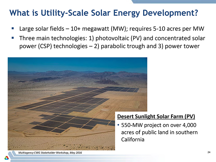
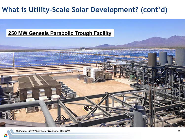
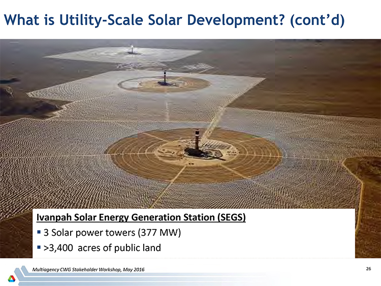
Following are key slides on bird mortality at largescale solar projects. See the complete presentation by Tom Dietsch in the middle of this pdf on the presentations.
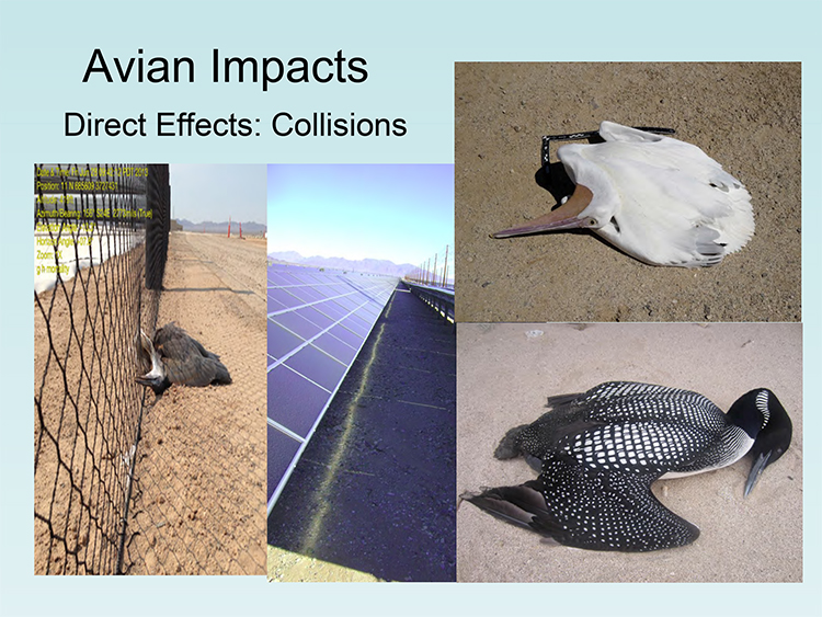
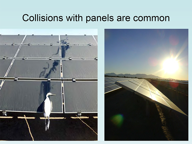
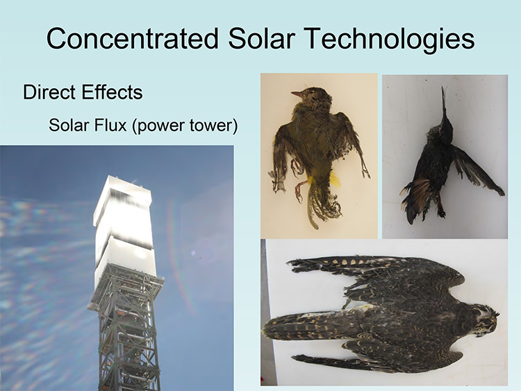
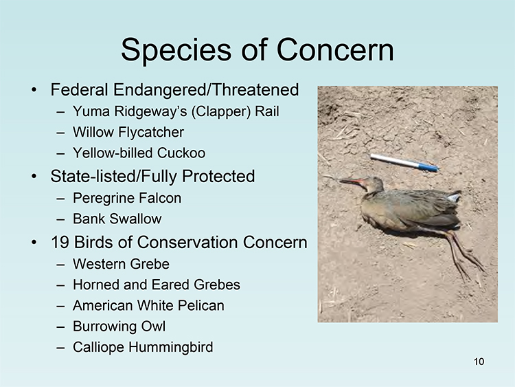
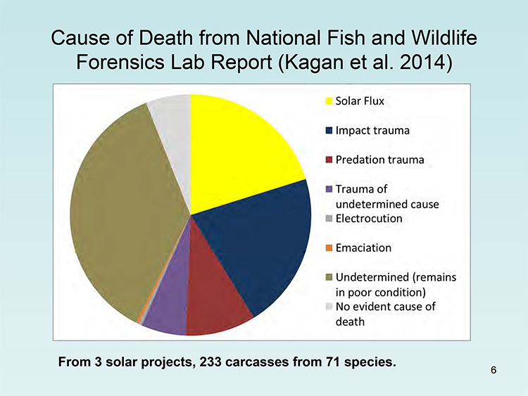
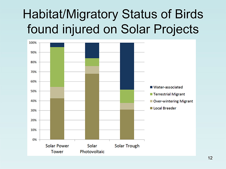
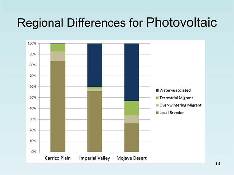
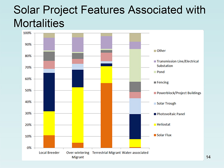
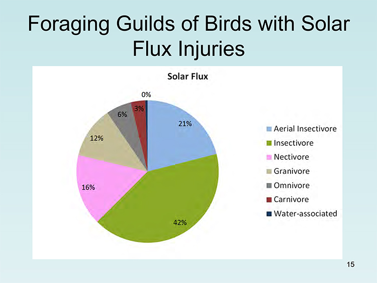
Mona Khalil of the USGS spoke next on potential mitigation strategies. Thermal video can detect birds in day and night, and studies are being undertaken at Ivanpah Solar Electric Generating System. "Solar Fatality Estimator" software could let the industry try to estimate fatalities that could happen at solar projects, although we doubt this software would produce accurate results as long as data fed into it is limited and full of gaps. "Evidence of Absence" software can be used to estimate whether rare species present or not. Again, we do not favor relying too heavily on models and software to replace actual fieldwork and data collection on site. Without the data and research, how will we know whether these software methods are not radically wrong?
For example, the small oasis at Miller's Rest Stop near Tonopah along US 95 in Nevada, an artificial tree planting and lawn next to ephemeral wetlands and a desert playa, has attracted multiple rare bird alerts and attracts birdwatchers annually from all over the state to check with binoculars the migrant diversity. Warblers from the Eastern Seaboard show up here, nonlocal sparrows, tropical flycatchers, and many more rarities. The only way this data is generated is by field observation, we do not see how software could have predicted the extremely diverse bird list of species present at this spot.
Avian Solar Working Group -- Industry and NGOs
Julie Falkner (Defenders of Wildlife) with Laura Abram (First Solar) discussed together their Avian Solar Working Group (ASWG). They said climate change is the largest threat to wildlife. Abram suggested doing studies on how many birds die without largescale solar projects present in the desert (we would like to see data showing how many coal and natural gas power plants have been decommissioned because of utility-scale solar power plants). The Avian Solar Working Group was convened by large-scale solar organizations. A research panel was formed to give "objective third party review." We doubt that the ASWG qualifies as an objective third-party review, since their goal is to minimize cost of building the maximum number of solar power plants, not conservation. The ASWG asked the agencies for funding to get research questions done. They invited agencies in as "observers" of what their priorities are (will there be a point when the public can participate in this process, since most of these projects are on public land?). The ASWG is mostly looking at collision and photovoltaic panels.
We are troubled by the lack of public involvement in this working group which seems to be industry-led and agency-invited, with a few NGOs, but no public input concerning projects which are largely on public land. When will the public be invited to comment on the ASWG's findings? This seems too much like a separate environmental review process, but shutting the public out.
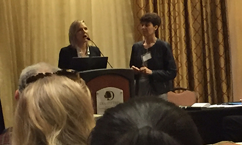
^Laura Abram of First Solar and Julie Falkner of Defenders of Wildlife.
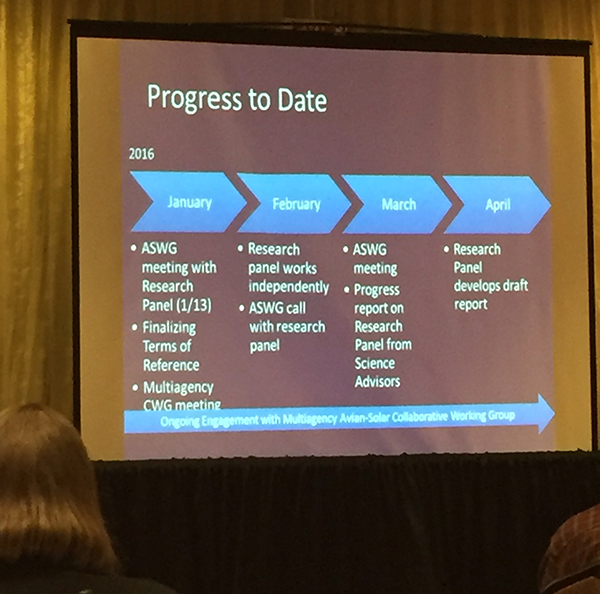
^Where is the public input in this "privatized" environmental review process by First Solar and friends?
Solar Flux Studies
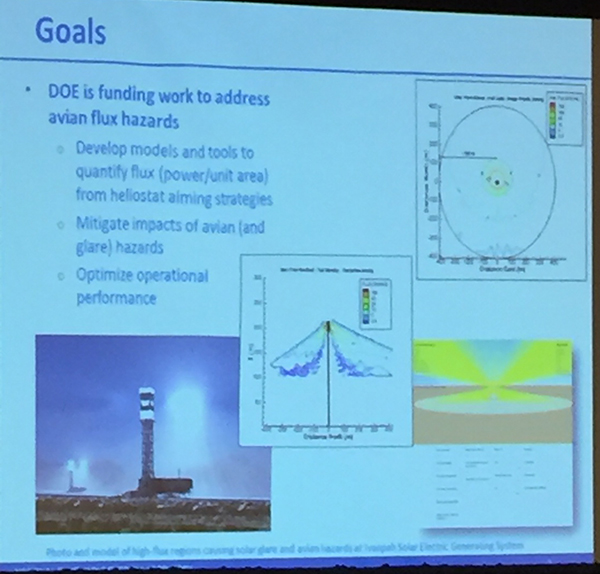
Timothy Wendelin of NREL and Sandia National Laboratory gave a presentation about solar flux and avian mortality that veered off into shear unscientific speculation. He defined solar flux as power incident on a surface per unit area. 600 kilowatts per square meter is typical. He said when the mirrors are in standby position, birds were particularly in danger. Wendelin claimed that during operation birds avoid the bright tower receiver. We strongly disagree with this statement: the most powerful solar flux is during operation when all or most mirrors are aimed at the tower receiver, creating a flux which birds still fly into. At the Ivanpah solar power towers, according to USFWS, most avian mortality is from operational solar flux. So there is a giant discrepancy between what is observed at Ivanpah and what Wendelin is saying. We have never heard any reports that birds simply "avoid" the bright light of the solar receiver during operation. Wendelin provided no evidence to back this claim. We have seen reports that dragonflies and other insects may congregate in the thermal air mass rising off operational solar power towers, and actually attract insectivorous birds -- this needs more study.
Wendelin asked how can you reduce flux. He said NRG is providing information on their Ivanpah power towers. NREL is looking at alternative standby positions for the heliostats, and developing tools to do online assessment of flux levels before a plant is built. There are ways to mitigate, he said. In Israel bird carcasses were hung in the flux, and it was claimed there was no damage under 50 kW/m2. But the California Energy Commission says 4 kW/m2 will do damage. Reasonable aiming strategies can work, Wendelin said. We disagree, since data collection has been so difficult to get from the Crescent Dunes power tower project in Nevada, even though it is on public land. There should be more open data collection and full public disclosure and study, before conclusions are reached about whether aiming strategies are working.
Wendelin also claimed that the amount of energy is not high enough in the flux to pyrolize a bird -- that a bird flying through the flux cannot be 'vaporized,' it just burns and drops to the ground. "Streamers" are most likely attributed to insects and not birds, he said (we disagree). The worst case is CEC's work on breaking down of protein in feathers, Wendelin said (again, we disagree -- evidence suggests birds can be disentegrated in the intense solar flux). "We must consider investors in solar companies and help them reduce costs." These statements by a federal laboratory are inconsistent with other studies on solar flux, as well as observations by biologists and filmed horned larks turning white-hot and vanishing in flux. And Wendelin admitted that it is a hotter flux in operation.
We asked about operational solar flux and bird mortality -- Wendelin was very hesitant, and said of operational flux -- "what I've heard, in operation there is reason to believe birds avoid it. Perhaps."
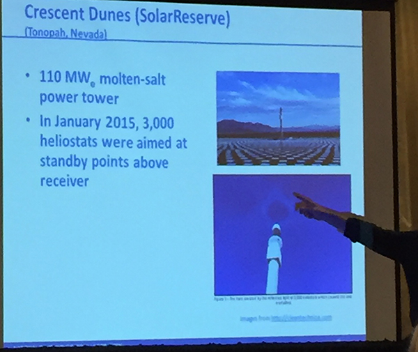
Solar Reserve representatives stood up and said they wanted to correct the record: it was not 115 birds in 4 hours killed in solar flux at Crescent Dunes. At the time it was thought to be birds, but later this was called into question and decided that these were not bird deaths, Solar Reserve added. Those observations "may have been dust or insects," it was claimed.
This reversal of bird mortality interpretation by a solar company, and lack of good science by NREL concerning operational solar flux and bird mortality, is exactly why we need more data and a slow-down in construction so that better research and mitigation practices can be developed. We need to keep good science in this process, not cut corners to keep investors happy. The investors are benefiting already from US Treasury grants, loans, tax incentives, and cheap public land leases.
Glare
At ISEGS managers said they have minimized the glare halo from early commissioning.
A representative from the California Energy Commission asked solar companies with power towers if they will analyze glare? He said whenever heliostats not on the receiver they are causing a glare up into sky to passing pilots. We agree this also needs more study for public safety in air travel.
Comparing Wind Project Avian Mortality
Elise DeGeorge of NREL talked about "mis-perceptions" concerning wind projects early on, calling this "misinformation" about eagle deaths at the Altamount Wind Resource Area. She said micro-sighting of wind turbine generators is important. This differs from eagle research sessions we have attended at conferences where the actual researcher gave a talk of his findings -- see here. She showed a chart purporting to show that bird deaths at wind farms are decreasing nationally -- she said one cannot look at single projects, but must look at the national average. This does not make sense to us.
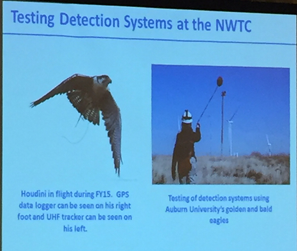
DeGeorge then showed how the next-generation larger wind turbine rotor tip could "allow birds to get through better." Again, this is an unfounded claim that had no references to back it up, and more research needs to be done. She explained about a test of shutting a wind project down and sending a tame peregrine falcon through, and testing technology to detect the falcon. Auditory deterrent systems to eagles may be developed. Lower wind speeds may cause more fatalities, and this could help derive cut in speeds.
Conclusion
In general we were disappointed in the lack of public participation in this workshop discussion, the dominance of the solar industry, and the great need for more open monitoring data for projects on public lands.
