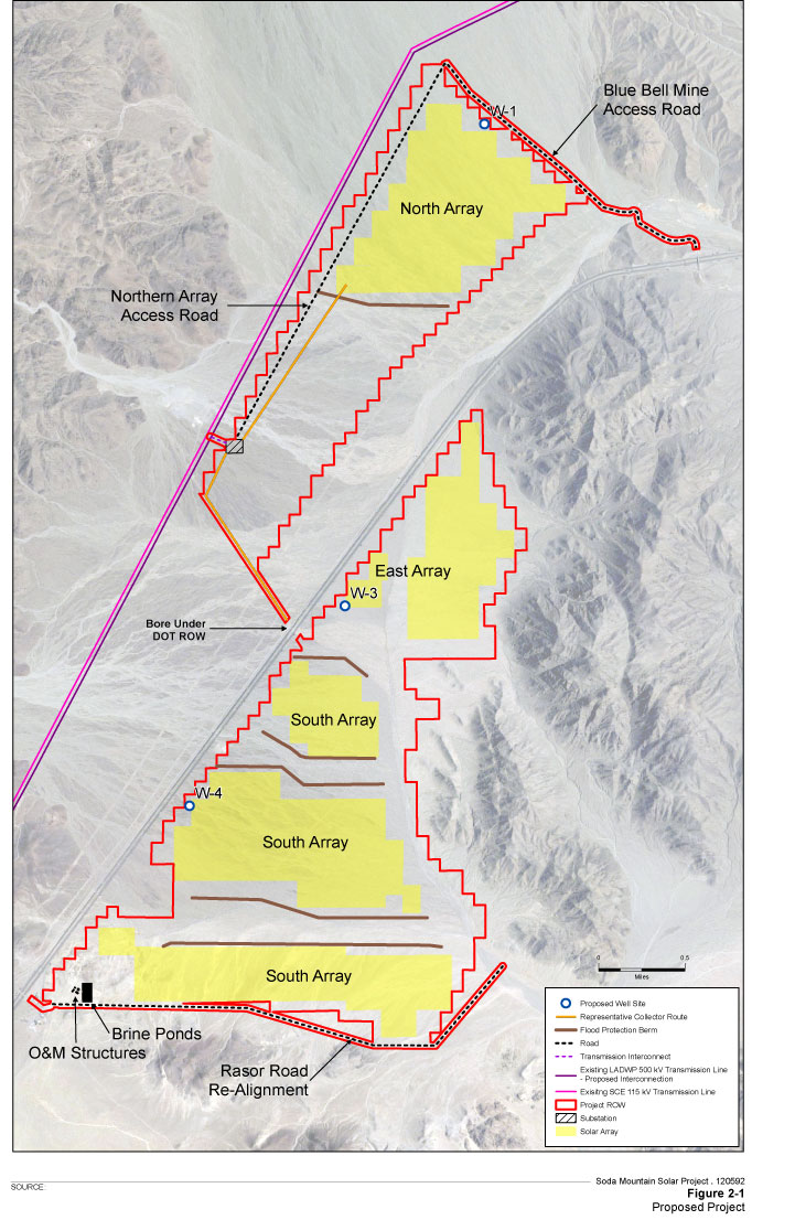
Latest Map and Lay-out of Project
June 6, 2013 - Near Zzyzx, CA. This photovoltaic solar project along Interstate 15 in San Bernardino County, CA west of Baker and north of Mojave National Preserve, has a new map. The highway is shown as a gray line, while an existing transmission line is shown in pink/purple. Rasor Road, leading to a popular off-roading area managed by the Bureau of Land Management, will be re-aligned. The largest changes, however, appear to be the flood control berms and channels between solar arrays, to allow existing washes to send water through the project after torrential rains.