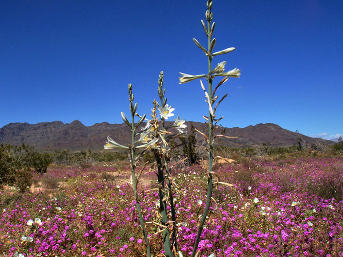
^Desert lily (Photo by Donna and Larry Charpied)
Page 1, page 2, page 3, page 4, Solar company tresspasses
Threats to a Desert Paradise
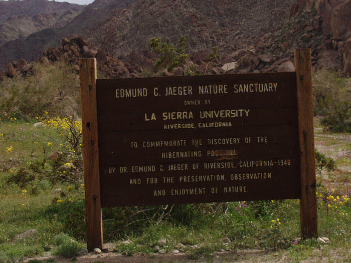
Our friend Donna Charpied, Executive Director of Citizens for the Chuckwalla Valley in Desert Center, Riverside County, California, supplied us with these photos and text describing the amazing biodiversity and shear beauty of this Colorado Desert valley and surrounding mountain ranges. Unfortunately this area has been under threat from many ill-conceived projects, including the Eagle Mountain landfill and rail project that would deliver 20,000 tons of trash each day from Los Angeles to a canyon next to Joshua Tree National Park for a hundred years. Lately, solar energy developers have moved in, eyeing huge acreages of wild desert landscape, and a large part of the valley has been designated a Solar Energy Study Area by the Bureau of Land Management (BLM) - see page 2 for maps. We hope these images show that this desert is not a lifeless wasteland to be carelessly scraped and trashed; it is a living landscape where wildlfowers bloom, animals abound, and people care for their home.
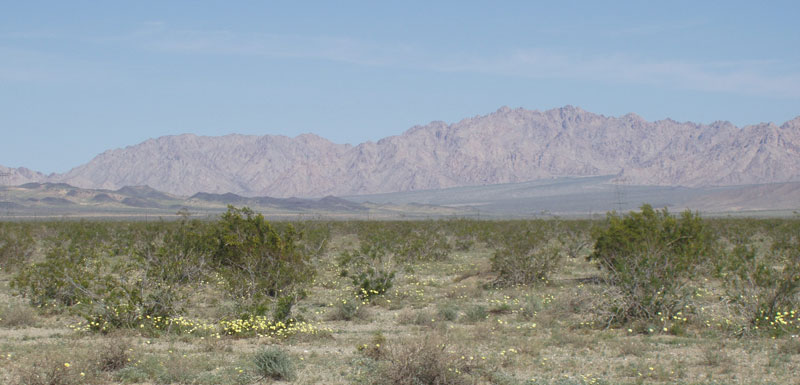
^Eagle Mountain. (Photo by Donna and Larry Charpied)
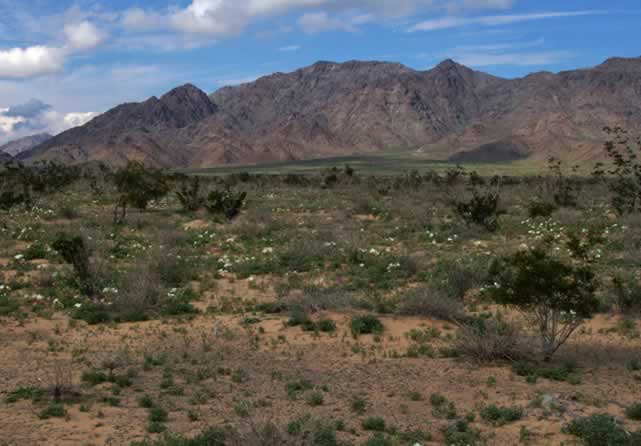
The Upper Chuckwalla Valley is home to Joshua Tree National Park Wilderness, Desert Center, and Eagle Mountain. Joshua Tree is characterized by vast and open vistas where human occupancy and associated development are rarely noticeable. This area is under siege. It is targeted for tens of thousand of acres of solar panels. This area is subject of a hydroelectric pump storage project, and is home to the proposed world’s largest garbage dump at Eagle Mountain. Joshua Tree National Park will surround these projects like an amphitheater if we don’t play our cards right. Environmentalists have spent 22 years halting the dump, we can do the same with misguided energy policies that will destroy one of America’s sacred places and will result in an irretrievable commitment to natural resources.
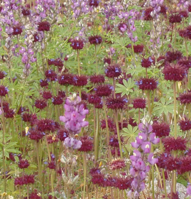
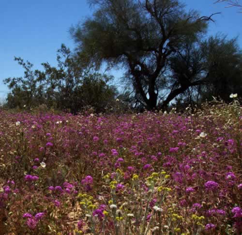
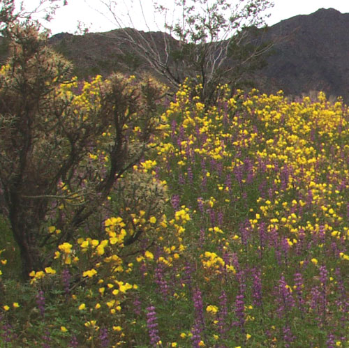
^Chia (Salvia columbariae) and lupines (Lupinus arizonicus) in a wet spring wildlfower show. (Photo by Donna and Larry Charpied)
Joshua Tree National Park is located in the Mojave and Colorado Deserts of Southern California. In 1936 Joshua Tree National Monument was established by presidential proclamation, to protect and preserve the area’s historic, prehistoric, and scientific features, including the natural resources of the Colorado and Mojave Deserts. This proclamation further recognized that it is in the public interest to reserve Joshua Tree as a National Monument. In 1976 Joshua Tree was given federal wilderness designation. In 1977 it received Class I wilderness airshed status. In 1984 it was designated a world biosphere reserve.
^Rare snow in the upper Chuckwalla Valley. (Photo by Donna and Larry Charpied)
In 1994 Congress reaffirmed that Joshua Tree is “a public wildland resource of extraordinary and inestimable value for this and future generations.” California Desert Protection Act, section 2(a)(1). On October 31, 1994 Congress added 234,000 acres to the monument, designated an additional 163,000 acres as wilderness, and affirmed Joshua Tree’s status as a nationally significant area by designating it a National Park. Congress’ stated purpose in doing so was to “secure for the American people of this and future generations an enduring heritage of wilderness, national parks, and public land values in the California desert.” Congress specifically cited the need to protect the Park from “incompatible development and inconsistent management of . . . contiguous Federal lands of essential and superlative natural, ecological, archeological, paleontological, cultural, historical, and wilderness values.” 16 U.S.C. § 410aaa(3). Today the Park comprises 794,000 acres.
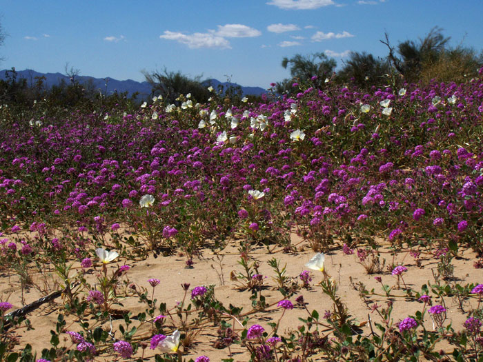
^Verbenas forever: Desert sand verbena (Abronia villosa). (Photo by Donna and Larry Charpied)
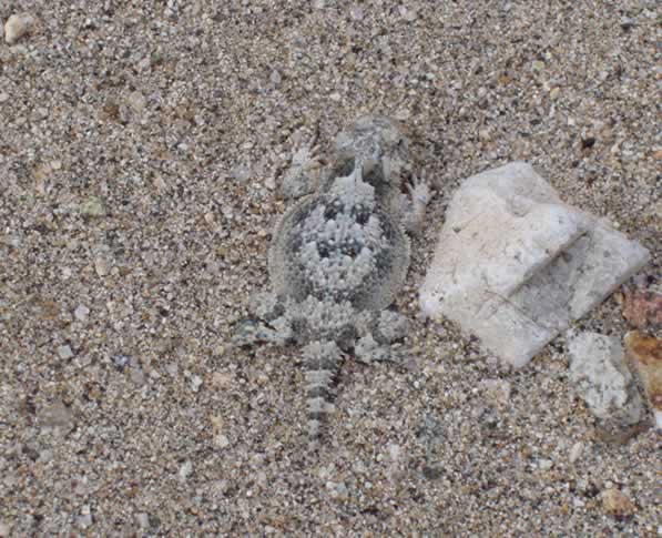
^Desert horned lizard (Phrynosoma platyrhinos) blends with the sandy ground well. (Photo by Donna and Larry Charpied)
^Lush native gardens with Mojave dandelion (Malacothrix glabrata). (Photo by Donna and Larry Charpied)
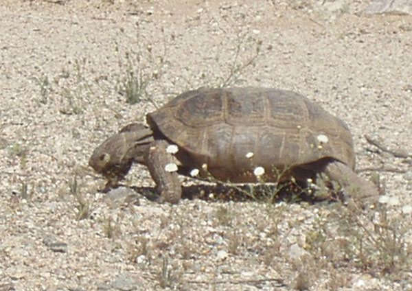
^Tortoise breakfast (Gopherus agassizii). (Photo by Donna and Larry Charpied)
^Lupines and Golden evening-primrose (Camissonia brevipes). (Photo by Donna and Larry Charpied)
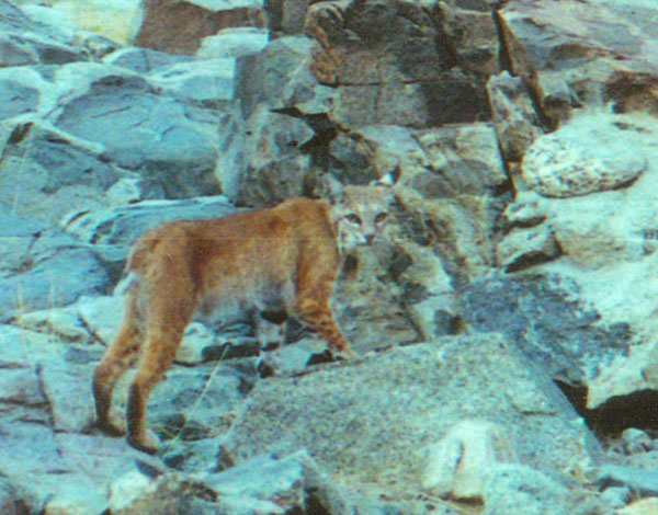
^Bobcat (Lynx rufus) in the Little Chuckwalla Mountains. (Photo by Jim Capp)
^Desert poppies (Eschscholzia sp.) and Notch-leafed phacelias (Phacelia crenulata). (Photo by Donna and Larry Charpied)
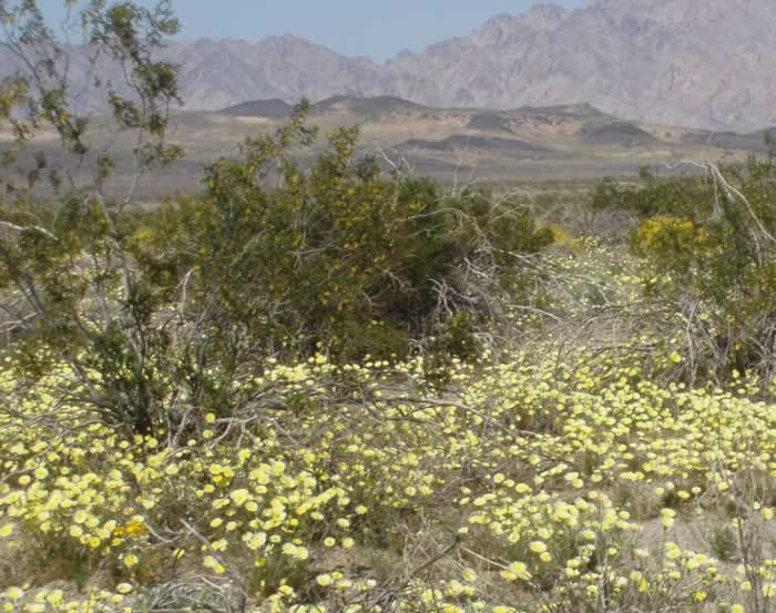
^Sacrifice zone? Tall Desert gold (Geraea canescens) and white pincushion flowers (Chaenactis sp.). (Photo by Donna and Larry Charpied)
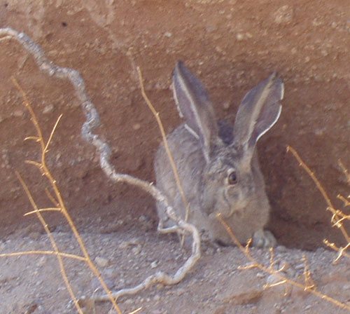
^Young Black-tailed jackrabbit (Lepus californicus). (Photo by Donna and Larry Charpied)
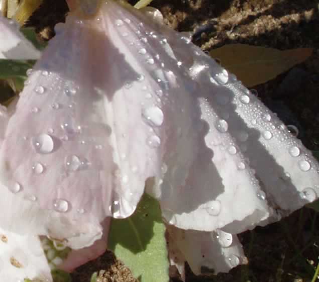
^Dune evening-primrose blossom (Oenothera deltoides) after a rain. (Photo by Donna and Larry Charpied)
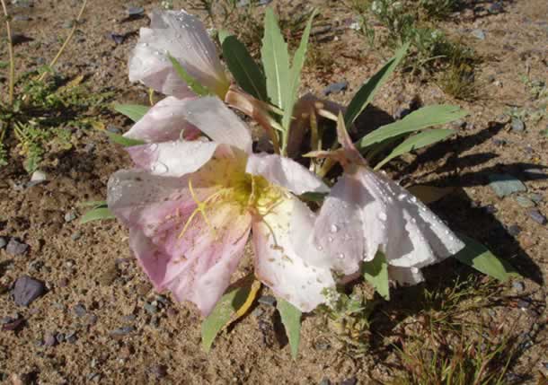
^Dune evening-primrose. (Photo by Donna and Larry Charpied)
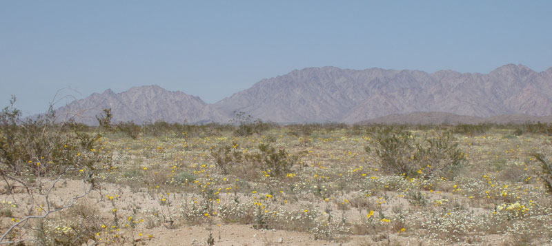
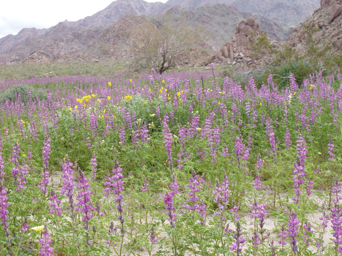
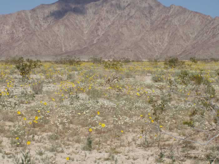
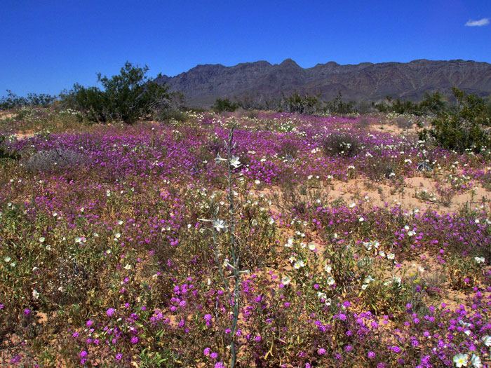
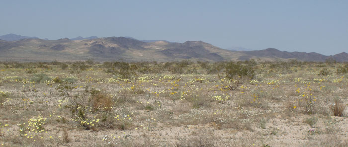
^Meadow of wildflowers with the Coxcomb Mountains in the background. (Photo by Donna and Larry Charpied)
Desert Center
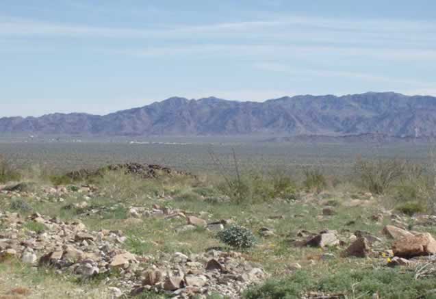
^The community of Desert Center seen from afar. (Photo by Donna and Larry Charpied)
Desert Center, founded by Desert Steve Ragsdale in 1921 lies along the I-10 freeway, about 60 miles east of Indio and 50 miles west of Blythe. Chevron plans a massive solar project along the I-10.
^The place where Mojave dandelion flowers (tortoise food) grow behind Desert Center is among the most beautiful spots in the Chuckwalla Valley. (Photo by Donna and Larry Charpied)
>The “Praying Woman” and Alligator Ridge have been photographed by amateur and professional photographers for many, many years. (Photo by Donna and Larry Charpied)
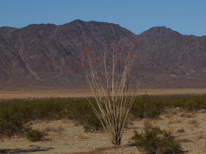
^Blooming ocotillo (Fouquieria splendens). (Photo by Donna and Larry Charpied)
Desert Center still has that old time feel to it, but it will soon be transformed into wall to wall mirrors if Big Energy have their way.
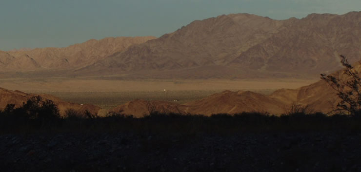
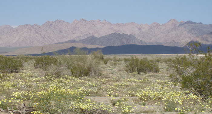
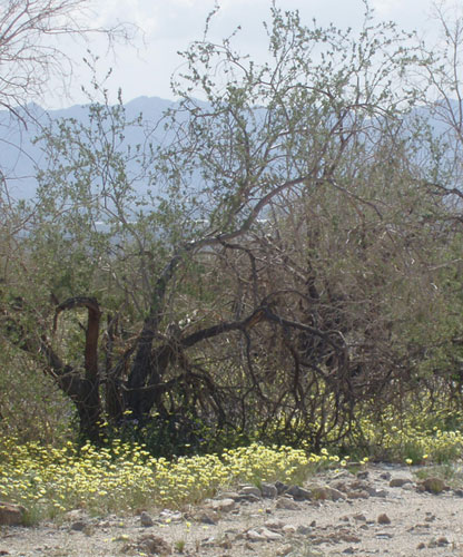
^Chuckwalla Valley floor targeted for solar projects. (Photo by Donna and Larry Charpied)
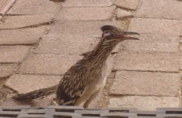
^Visiting Roadrunner (Geococcyx californianus). (Photo by Donna and Larry Charpied)
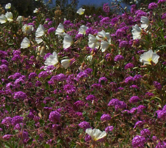
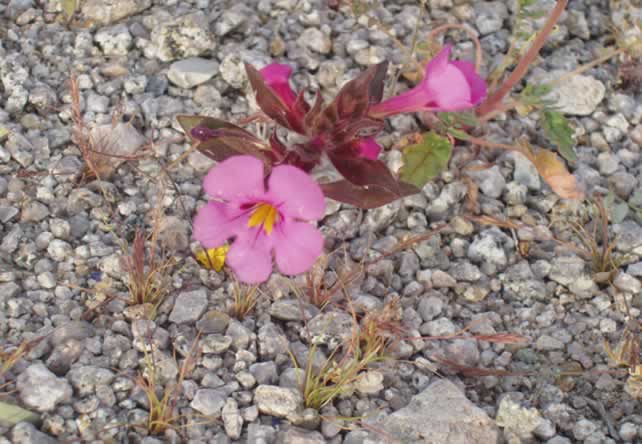
^Verbena and primrose. (Photo by Donna and Larry Charpied)
Lilies of the Desert
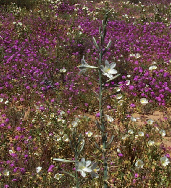
^Desert lily (Hesperocallis undulata) among fields of Verbena. (Photo by Donna and Larry Charpied)
^Desert lily natural garden. (Photo by Donna and Larry Charpied)
Tasker and Beula Edmiston first observed the desert lily on Easter Sunday 1957. The Edmistons worked tirelessly with the BLM to protect this outstanding natural area. On Easter Sunday 1968, a 2,000 acre site was selected for protection because of its floral values. Today the Desert Lily Sanctuary is preserved by the California Desert Protection Act.
^(Photo by Donna and Larry Charpied)
The Lily Reserve is approximately 15 miles from the Desert Center exit on HWY 177 (a.k.a. Rice Road). Solar panels are proposed virtually across the street from the sanctuary.
There is a land bridge (little known dunes in Upper Chuckwalla Valley) that flows from the mouth of the Pinto Basin, to the Lily Sanctuary than follows the base of the McCoy Mountains. This is an extremely important habitat connection between wilderness, open space, to the sanctuary.
^Sand bridge connects habitats across the valley. (Photo by Donna and Larry Charpied)
This and much more will be lost to misguided energy policies.
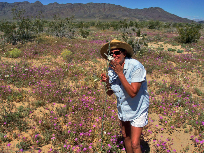
^Donna Charpied and tall Desert lily. (Photo by Donna and Larry Charpied)
^Bigelow mimulus (Mimulus bigelovei). (Photo by Donna and Larry Charpied)
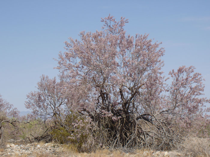
^Flowering Ironwood tree (Olneya tesota), commonly forming low woodlands along washes in the area. (Photo by Donna and Larry Charpied)
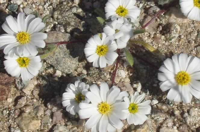
^Desert star (Monoptilon bellioides). (Photo by Donna and Larry Charpied)
^Verbena in the lily preserve. (Photo by Donna and Larry Charpied)
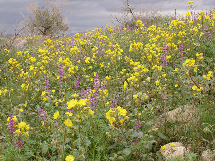
^Lush Golden evening-primrose after the 2005 wet winter. (Photo by Donna and Larry Charpied)
Rare Plants and Wildlife
Several sensitive species have been found along the railroad that goes through the Chuckwalla Bench Area of Critical Environmental Concern, and nearby Orocopia Wilderness. This rail track crosses under I-10 at Red Cloud Road, goes through tortoise critical habitat, then runs along the southeast boundary of Joshua Tree Wilderness to the Eagle Mountain mine site where the dump is proposed. The solar energy company OptiSolar told residents they plan to revamp the railroad to bring equipment to Chuckwalla Valley to construct their massive solar project. These are some of the rare species that would be affected by these projects in the area:
• FOXTAIL CACTUS (Coryphantha alversonii): A federal Category 2 candidate (information is currently being collected to see if the species should be listed as threatened or endangered) and a California Native Plant Society (“CNPS”) 1B species (plants rare, or endangered in California and elsewhere).
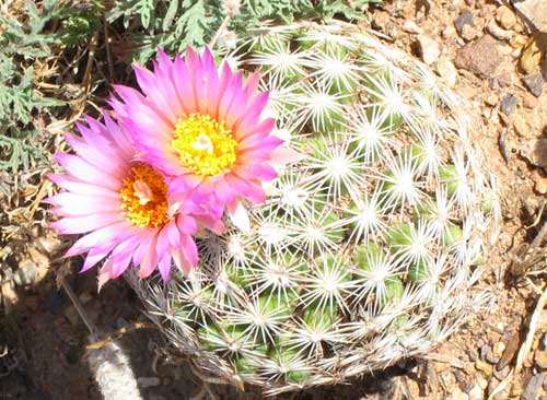
^A little-seen cactus similar to this Arizona beehive cactus (Coryphantha vivipara) dwells in the Chuckwalla Valley area.
• CALIFORNIA BARREL CACTUS (Ferocactus cylindraceus): A BLM Sensitive species observed within the dump’s footprint, near access roads, and along the rail line.
• OROCOPIA SAGE (Salvia greatae): A federal Category 2 candidate and a CNPS List 1B, observed along the rail line. This plant is only found in the Orocopia and Chocolate Mountains around Chuckwalla Valley.
• DESERT PUPFISH (Cyprinodon macularius): A federal and state listed endangered species. Observed approximately 1/4 mile south of the Eagle Mountain railroad trestle in a tributary of Salt Creek, Riverside County, and earlier surveys report the species is present throughout Salt Creek. Studies indicate that the best pupfish habitat in the area begins approximately 1 mile below the rail trestle and extends upstream to the headwaters of the tributary. Of particular interest is that this species could be wiped out with the planned construction/repair of the railroad. It is virtually impossible to relocate this species because each pool is minerally unique in composition (Personal conversation with National Park Service in Death Valley).
• COMMON CHUCKWALLA (Sauromalus obesus): A federal Category 2 species occurring at the project site and moderate occurrence along the rail line.
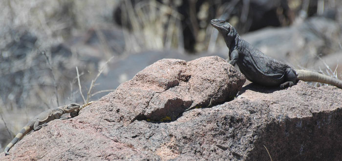
^A small juvenile Chuckwalla is cautious around a big male, as they share a basking boulder.
• FLAT-TAILED HORNED LIZARD (Phrynosoma mcallii): This species has been proposed for federal listing as threatened and is a California Species of Special Concern. It occurs in the vicinity of the rail line near Ferrum Junction, south of Chuckwalla Valley by the Salton Sea (Riverside County).
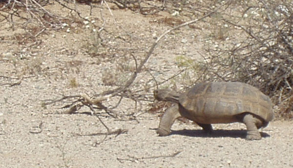
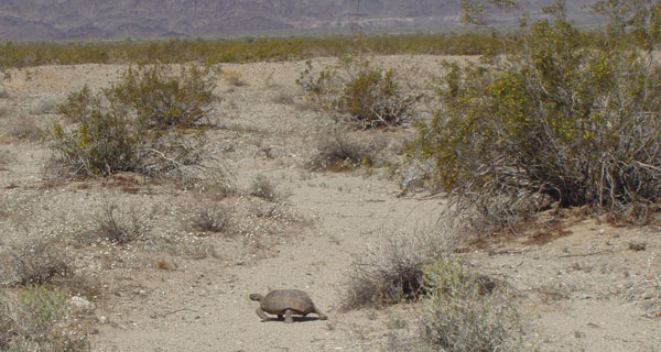
• DESERT TORTOISE (Gopherus agassizii): This species is federal and state listed as threatened. Tortoise have been observed north of I-10 in the Eagle Mountain study area, the Chuckwalla Bench north of the Chocolate Mountains, and on the railroad. The Eagle Mountain railroad and parts of Eagle Mountain road cut through the Chuckwalla Unit of Critical Habitat for desert tortoise. The impacts to this species is not only from train and truck traffic. Ravens historically are attracted to dumps, and ravens prey on juvenile tortoise. It is expected that predation on the desert tortoise will increase. (Personal conversation with Park ecologist). A recent report by Dr. Richard Knight of the University of Colorado describes the Park’s Pinto Basin as the most pristine raven habitat in all of the Mojave desert. He regards Joshua Tree National Park as a unique habitat with unaltered raven densities. There are a number of mitigation measures to decrease the impacts to the desert tortoise, however the effectiveness of some of the mitigation strategies are unproven.
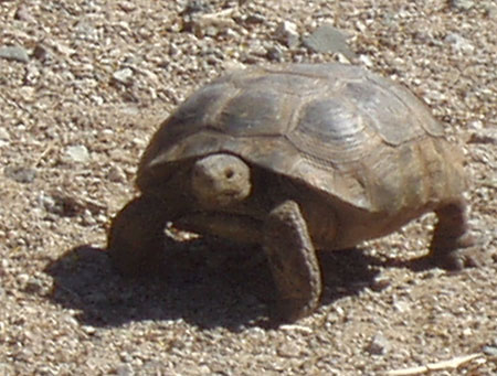
^Desert tortoise. Large solar energy developments would also wipe out much habitat used by these herbivorous reptiles. (Photo by Donna and Larry Charpied)
^(Photo by Donna and Larry Charpied)
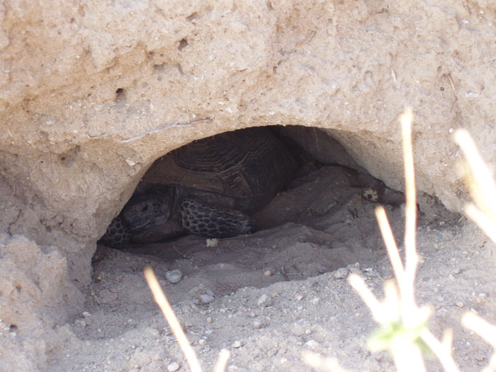
^Tortoise in burrow. (Photo by Donna and Larry Charpied)
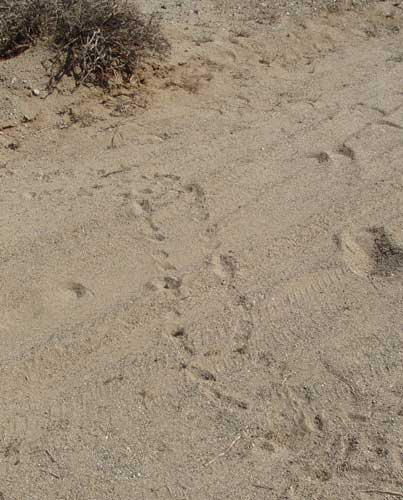
^Tortoise tracks. (Photo by Donna and Larry Charpied)
• NORTHERN HARRIER (Circus cyaneus): A California Species of Special Concern. This species is considered to occur seasonally along the rail line, and may forage in habitat at the project site and along access roads.
• SHARP-SHINNED HAWK (Accipiter striatus): A California Species of Special Concern. Likely to migrate in the vicinity of the project in the fall and spring, and may winter in any part of the project area. The species may also seasonally forage in habitat at the project site and along the rail line.
• COOPER’S HAWK (Accipiter cooperii): A California Species of Special Concern. Most parts of the project area are within the year-round ranges, although the central part of the rail line passes through an area of winter-range only.
• GOLDEN EAGLE (Aquila chrysaetos): A California Species of Special Concern. None were identified during the surveys for the project, however the species is highly likely to occur in any portion of the project area. Note: Larry & I have observed these beauties several times in this area
• PEREGRINE FALCON (Falco peregrinus): Is a federal and state listed endangered species with a low to moderate probability to occur at the project site, access roads, and rail line.
• CALIFORNIA BLACK RAIL (Laterallus jamaicensis coturniculus): A federal Candidate 2 candidate and is state listed as threatened. Have been observed in the Salt Creek area north of the rail line, and do occur within one mile of the project area.
• YUMA CLAPPER RAIL (Rallus longirostris yumanensis): A federally listed endangered species and state listed threatened species, observed in the Salt Creek area north of the rail line.
• WESTERN BURROWING OWL (Athene cunicularia): A federal Category 2 candidate species and a California Species of Special Concern, with a moderate likelihood of occurrence at the project site, access roads, and rail line.
• BLACK-TAILED GNATCATCHER (Polioptila melanura): Considered a California Special Animal (an animal fully protected by the state) by California Department of Fish and Game, and observed near Kaiser & Eagle Mountain Roads and on the project site.
• LECONTE’S THRASHER (Toxostoma lecontei): A federal Category 2 candidate and California Species of Special Concern, observed near Kaiser & Eagle Mountain Roads and could nest in habitat at the project and along the rail line.
• LOGGERHEAD SHRIKE (Lanius ludovicianus): A California Species of Special Concern that is expected to occur throughout the project area.
• YELLOW WARBLER (Dendroica petechia): A California Species of Special Concern observed in the townsite and the Chuckwalla Bench Area of Critical Environmental Concern (“ACEC”).
• YELLOW-BREASTED CHAT (Icteria virens): A California Species of Special Concern observed in the townsite and expected to occupy habitats throughout the project area.
• CALIFORNIA LEAF-NOSED BAT (Macrotus californicus): A federal Category 2 candidate and a California Species of Special Concern who uses the Kaiser Mine as a winter roost. There have been no other winter roosts located during air searches over the Orocopia, Chuckwalla and Coxcomb Mountains.
• TOWNSEND’S BIG-EARED BAT (Plecotus townsendi): A federal Category 2 candidate and a California Species of Special Concern. Maternity roost of this species was observed in the mine adit during 1990 surveys, however subsequent surveys did not identify this species, possibly indicating that the roost has been abandoned. If the species is present, it is likely to forage in nearby areas, including near access roads & rail line and areas closer to the mine.
• CALIFORNIA MASTIFF BAT (Eumops perotis): A Category 2 candidate and a California Species of Special Concern. None were identified in a 1990 survey, but suitable habitat is present, and the species could occur at the Eagle Mountain project site. The entire project area is within the range of the species.
• PALLID BAT (Antrozous pallidus): A California Species of Special Concern was captured in a mist net over a mine pit pond during the 1990 surveys, and guano was found in two adits west of the project site. The species is likely to forage in areas near access roads and rail line, and it is known to forage over pond water, which forms from standing water after a rainfall in the bottom of the east pit.
• AMERICAN BADGER (Taxidea taxus): A California Species of Special Concern identified at the project site and near Kaiser Road. The species is highly likely to occur along the rail line and Solar Energy Study Area.
• YUMA MOUNTAIN LION (Puma concolor browni): A Category 2 candidate and California Species of Special Concern. In 1995 and 1996 mountain lions have been observed at the Eagle Mountain townsite, and several farms in the Desert Center/Eagle Mountain area.
• NELSON’S BIGHORN SHEEP (Ovis canadensis nelsoni): A California Special Animal observed at the project site, and several locations along the Eagle Mountain railroad.
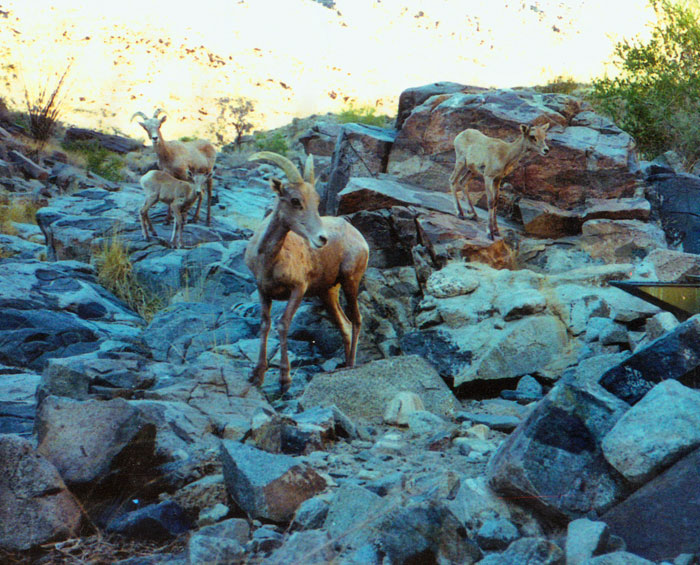
^Bighorn sheep in the Little Chuckwalla Mountains behind Desert Center (Photo by Jim Capp).
Biodiversity is the concept that all components of ecological systems, both living and nonliving, are interconnected in a hierarchical continuum, and that changes in the diversity at any level in that hierarchy can have effects at other levels. The Council on Environmental Quality, has identified several primary threats to biodiversity, including:
• Physical alteration of ecosystems from resource exploitation and changing land use including habitat destruction, degradation and fragmentation;
• Pollution, which can have direct lethal or sublethal effects, or can degrade habitat through such factors of eutrophication, acidification, or thermal pollution;
• Overharvesting of populations, which results in disruption of interconnections within and/or between species, thus affecting ecosystem function;
• Introduction of exotic species, which can eliminate native species through predation, competition, or disease transmission, thus altering interconnections between species and changing ecosystem function; and
• Disruption of natural processes, which can occur when land management procedures change ecosystem dynamics through such practices as fire suppression or changes in water flow regimes.
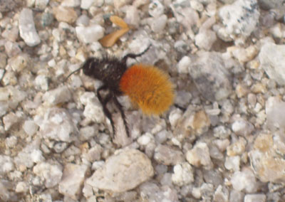
^Velvet ant. (Photo by Donna and Larry Charpied)
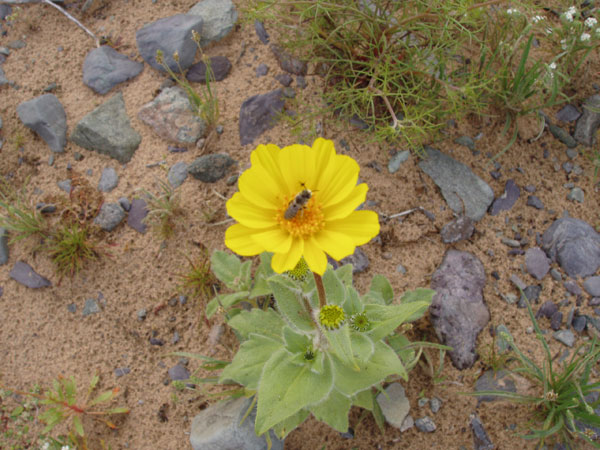
^Native bee polinating Desert gold. (Photo by Donna and Larry Charpied)
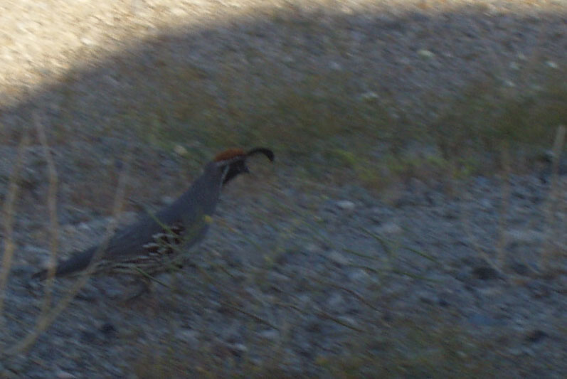
^Gambel's quail (Callipeple gambelii). (Photo by Donna and Larry Charpied)
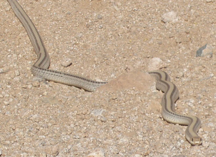
^Western patch-nosed snake (Salvadora hexalepis). (Photo by Donna and Larry Charpied)
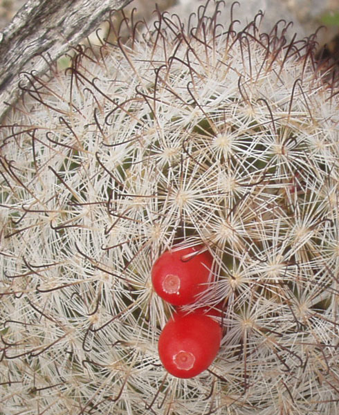
^Fish-hook cactus fruit (Mammillaria tetrancistra). (Photo by Donna and Larry Charpied)
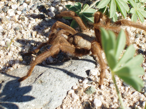
^Tarantula. (Photo by Donna and Larry Charpied)
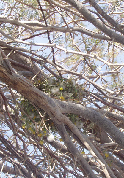
^Bird nest made of wildflowers in a mesquite. (Photo by Donna and Larry Charpied)
^Desert dandelions and Ironwood trees. (Photo by Donna and Larry Charpied)
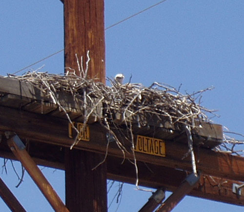
^Baby Red-tailed hawk (Buteo jamaicensis) in nest. (Photo by Donna and Larry Charpied)
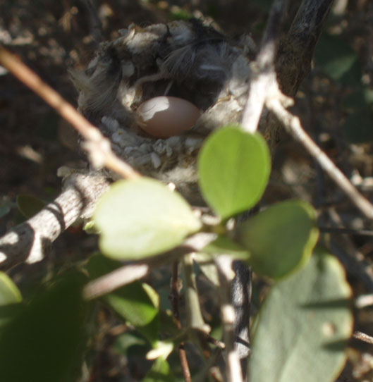
^Hummingbird nest with egg. (Photo by Donna and Larry Charpied)
^Tortoise cruising by creosote. (Photo by Donna and Larry Charpied)
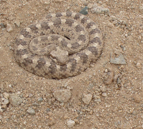
^Coiled Sidewinder (Crotalus cerastes). (Photo by Donna and Larry Charpied)
Vistas to Solar Overload?
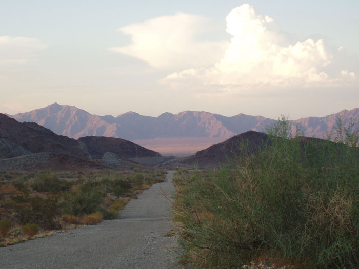
^Old truck route in the upper Chuckwalla Valley. (Photo by Donna and Larry Charpied)
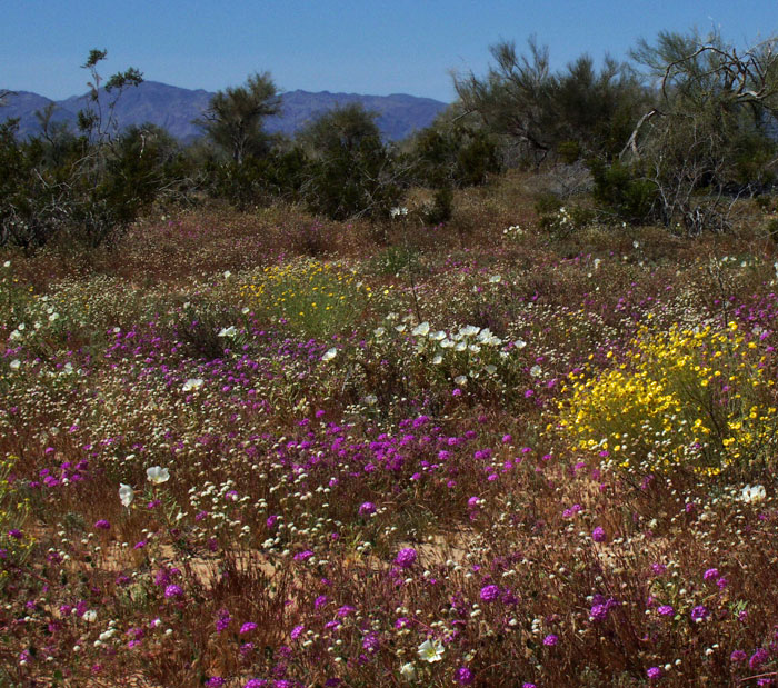
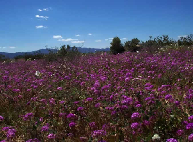
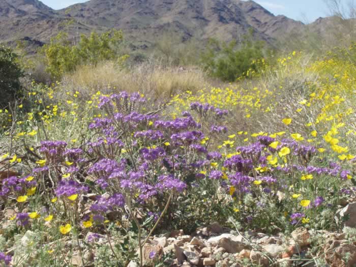
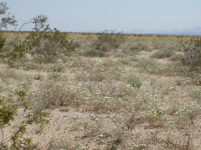
^Sensory overload of colorful flowers. (Photo by Donna and Larry Charpied)
^Desert gold and pincushion near the mouth of Pinto Basin. (Photo by Donna and Larry Charpied)
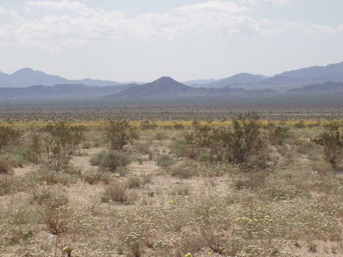
The scenery of the Upper Chuckwalla Valley is second to none. The area is a virtual science class with beautiful vistas for the artists, a myriad of wildlife and flowers that overload the senses.
In the background of all of these pictures is Joshua Tree National Park Wilderness. Solar panels are slated for the valley floor shown in the images as well as along I –10.
The people of the United States as well as people worldwide visit this majestic area for the solitude, peace, and soul massaging that is lacking in the urban areas.
-Donna Charpied, Executive Director
Citizens for the Chuckwalla Valley
Desert Center
^Site of a proposed future solar energy development. (Photo by Donna and Larry Charpied)
^Lilies and pincushion flowers where solar panels will be? (Photo by Donna and Larry Charpied)
^Primrose view. (Photo by Donna and Larry Charpied)
^Rain and wildflowers. Pencil cholla (Cylindropuntia ramosissima), Golden evening-primrose and Arizona lupines. (Photo by Donna and Larry Charpied)
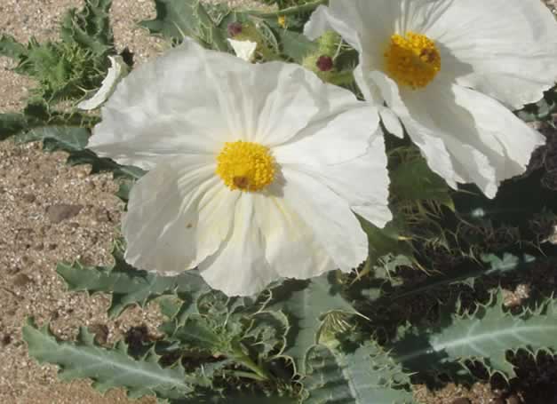
^Prickly poppy (Argemone polyanthemos). (Photo by Donna and Larry Charpied)
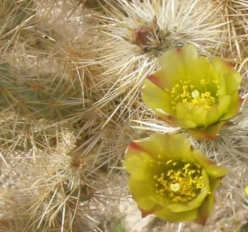
^Silver cholla blooms (Cylindropuntia echinocarpa). (Photo by Donna and Larry Charpied)
^Solar panels will be virtually on top of these verbena and Dune evening-primrose. (Photo by Donna and Larry Charpied)
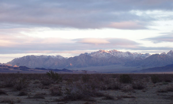
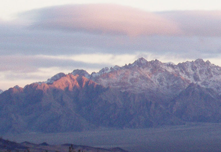
^Snowy mountains: will solar development replace the natural world here? (Photo by Donna and Larry Charpied)
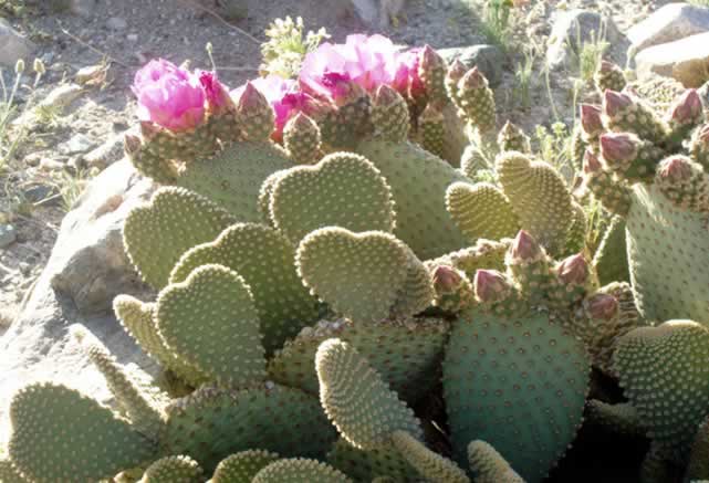
^"The desert is all heart." Beavertail cactus (Opuntia basilaris). (Photo by Donna and Larry Charpied)
MORE...
Page 2- Maps of Chuckwalla Valley area showing Solar Energy Study Areas, Wilderness areas, and Parks.
Page 3- The Eagle Mountains, article by Alfredo Figueroa.
Page 4- Land of Ironwood and Cholla: Chuckwalla Bench. Explorations for the elusive Burro Deer.
August 18, 2009 Update: First Solar, Inc. "Desert Sunlight" Photovoltaic Project announced >>here
November 2009 Update: Solar company tresspasses on private land and off-roads in tortoise habitat, near Desert Center >>here.
All photographs copyright 2009.
HOME.....Page 2.....Page 3.....Page 4........."A Better Way" - Distributed Generation