BrightSource Puts Project on Hold
January 13, 2013 - In a surprise move, BrightSource Energy suspended its power tower project indefinitely, telling the Desert Sun that too many issues face the project: US Fish and Wildlife concern over bird mortality, significant resources to Colorado River tribes, large fossil beds, dense ironwood forests with rare elf owls, and costs of mitigation. Sothern California Edison and the applicant canceled the power purchase agreement, and BrightSource will turn to developing the Palen solar project.
California Public Utlities Commission Denies One Utility Contract
October 26, 2012 - The project may be down to one power tower now, from the original three. Yesterday the the California Public Utilities Commission (CPUC) unanimously approved two amended BrightSource contracts with Southern California Edison (SCE): one tower (and not two as BrightSource had proposed) for their Rio Mesa project, and one tower for their Sonora West proposed project. Both projects are south of Blythe, CA. The Sonora West project would use molten salt storage tanks. The CPUC denied SCE's contracts for the three other projects: the second 200 megawatt (MW) project at Rio Mesa and two 200 MW projects at the proposed Siberia site which BrightSource has in its pipeline in the Mojave Desert of CA. We will wait to see if the California Energy Commission follows suit and requests the applicant to reduce its proposal before that licensing agency to one tower as well. See Reuters, Mojave Desert Blog, and KCET's ReWire.
California Energy Commission Releases Environmental Review Documents
October 2, 2012 - Parts A and B of the Preliminary Staff Assessment (PSA) were released on September 28 and later in October, discussing the Rio Mesa Solar Electric Generating Facility. >>HERE
US Fish and Wildlife Service Comments on Power Tower Technology
August 31, 2012 - A workshop was held on solar flux issues of power towers on August 29 in Sacramento by the California Energy Commission, specifically addressing the Rio Mesa and Hidden Hills projects proposed by BrightSource Energy. The US Fish and Wildlife Service has been concerned with bird mortality in the intense concentrated solar energy focusing on the 700-foot tall tops of the power towers as sunlight is reflected from thousands of large mirrors.
The USFWS letter dated August 29 to CEC included many detailed questions about how birds might be impacted by tower tower solar flux.
The letter continued: "Increasing our knowledge about potential impacts from this technology would further our ability to complete science-based analyses of direct, indirect, and cumulative effects to the avian community, as required by our joint public trust responsibilities. Therefore, we suggest that the Agencies limit the number of power tower projects that are considered for permitting and development until we obtain a more detailed understanding of this technology and its impacts, based on at least a couple years of scientifically robust monitoring. Deploying technology of this scale in multiple places and on a short timeframe without such an understanding compromises our ability to make informed decisions on projects that would permanently and cumulatively impact species and the extensive tracts of desert habitat upon which they depend."
The letter is >>here.
It mysteriously disappeared days after being posted on the Energy Commission website. KCET's ReWire by Chris Clarke had previously written an article about the letter: U.S. Fish & Wildlife Service Wants Moratorium On Solar Power.
Transmission Line will Need Environmental Review
August 29, 2012 - Bureau of Land Management today issued a Notice of Intent to prepare an Environmental Impact Statement and possible Land Use Plan Amendment for a Right of Way for an 8-mile gen-tie line, an approximately 3-mile emergency power line, and an approximately 1.6 miles of access roads on BLM-managed land to the Rio Mesa Solar Electric Generating Facility.
The Project's 230-kilovolt (kV) gen-tie line is proposed to parallel the existing Imperial
Irrigation District F Line from where it crosses the Rio Mesa generation site north to the Southern California Edison Colorado River Substation where it could connect the Project to the regional transmission grid. Due to the number of transmission lines in this
location, the BLM will consider whether the California Desert Conservation Area Plan should be amended by designating this area as a utility corridor.
ADDRESSES: You may submit scoping comments for the proposed Rio Mesa Gen-Tie Project by any of the following methods:
Web site: http://www.blm.gov/ca/st/en.html;
Email: CARioMesa@blm.gov;
Fax: 951-697-5299; or
Mail: Lynnette Elser, Planning and Environmental Coordinator, BLM California Desert District Office, 22835 Calle San Juan de Los Lagos, Moreno Valley, CA 92553.
The comment deadline is September 28, 2012.
BrightSource Drops Third Tower
May 11, 2012 - The Rio Mesa solar project would be scaled back from three power towers to two, announced BrightSource Energy. The project would be 500 megawatts, which already has a Power Purchase Agreement from Southern California Edison. The footprint would be reduced to 1,800 acres. The need to move an Imperial Irrigation District transmission line would be jettisoned. Most of the land involved is owned by Metropolitan Water District of Southern California.
Power Tower Project Along the Colorado River
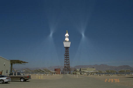 <The small Solar 1 and later 2 power tower at Daggett, since dismantled. The heliostats in this photo are in "standby" position, aiming the sunlight beams next to the tower receiver, in readiness to focus at the receiver to boil water and produce steam for an electric generator. BrightSource Energy's power towers at Rio Mesa will have thousands of standby points in a ring around the receiver instead of two.
January 7, 2012 - A workshop was held in Sacramento on January 6 in the California Energy Commission building, for the proposed Rio Mesa Solar Electric Generating Facility which is just beginning review. Biologists from US Fish and Wildlife Service, US Bureau of Land Management, and California Department of Fish and Game were particularly well represented.
Big issues that came up were the proximity of the giant solar power tower plant to more than one National Wildlife Refuge along the Colorado River, in the Pacific Flyway. This is new territory for all concerned -- biologists, agencies, and the solar industry. How to mitigate or avoid bird mortality from 750-foot tall power towers surrounded by thousands of mirrors reflecting sunlight onto central receivers that become so hot they flash-boil water into steam.
The Project
From the California Energy Commission website: The Rio Mesa Solar Electric Generating Facility (Rio Mesa SEGF) is being proposed for development by Rio Mesa Solar I, LLC, Rio Mesa Solar II, LLC, and Rio Mesa III, LLC, subsidiaries of BrightSource Energy, Inc., a Delaware corporation.
The proposed project site consists of three 250-megawatt (MW) (nominal) solar concentration thermal power plants situated on the Palo Verde Mesa in Riverside County, California, 13 miles southwest of Blythe, and is located partially on private land and partially on public land administered by the United States Bureau of Land Management (BLM). Each plant will utilize a solar power boiler, located on top of a concrete tower (approximately 750-feet tall), surrounded by heliostat (mirror) fields (approximately 85,000 per plant) which focus solar energy on the boiler. Auxiliary boilers will be used to operate in parallel with the solar field during partial load conditions and when additional power is needed. [We note these auxiliary boilers burn natural gas.]
Each 250 MW plant requires about 1,850 acres (or 2.9 square miles) of land to operate. A 119 acre common area will include a combined administration, control, and maintenance facilities. The total area required for all three plants, including the shared facilities, is approximately 5,750 acres.
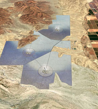
^Digital image of the proposed project.
Project Location: Desert and Bird Wetlands
During the workshop, Todd Stewart, Project Development Manager for BrightSource, explained that the power towers will be made of cement instead of steel lattice as at the Ivanpah project. Each would be 750 feet tall with a ten foot lightning rod on top.
The project location is at 350 feet elevation above sea level. The total project would occupy 7,000 acres, but 5,750 would be occupied by the three plants. A gen-tie line would disturb an additional 125 acres, to connect with a Southern California Edison main transmission line.
The land history of the site is varied: in the 1970s San Diego Gas and Electric proposed a nuclear power plant. We note local opposition helped defeat this plan. Dozens of test wells were drilled, and BrightSource is looking at them for data. General Patton used the area of maneuvers during WWII, and Stewart said the area currently is used by OHV recreationists.
On November 8, the Riverside County board brought land into conformance with zoning for a solar project; part of the project would lie on Metropolitan Water District land (the southern two projects), with the rest on Bureau of Land Management land (the northern project).
To the east and south the project avoids large desert washes with microphyll woodland. This type of desert vegetation consists of trees with deep taproots to reach groundwater: desert ironwood (Olneya tesota), palo verde (Parkinsonia florida), and mesquite (Prosopis spp.). The Mule Mountain foothills are adjacent to the project. "Challenging terrain" to the north was also avoided.
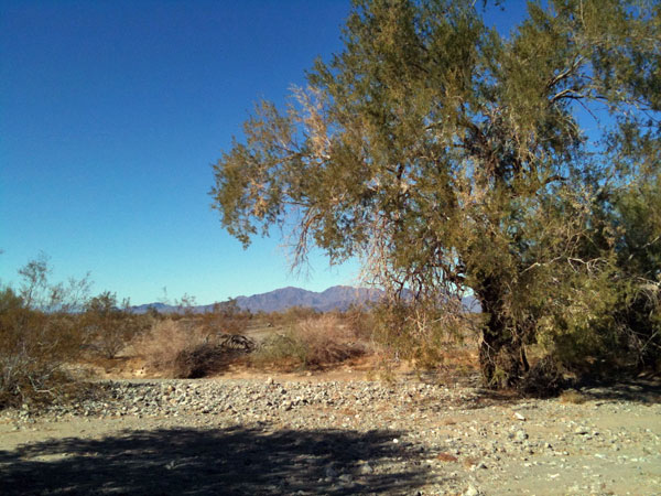
^Microphyll woodland in Chuckwalla Valley, consisting of Desert ironwood trees. We photographed this area near the McCoy Mountains to the north and west of the proposed Rio Mesa Project.
BrightSource says no wholesale grading will be done in the solar fields, but as at Ivanpah, we presume this means cutting vegetation and truck traffic over the desert floor. Stewart claimed the site was previously disturbed but not developed. We have learned that the definition of "disturbed" is open to interpretation. US Fish and Wildlife Service biologists piped up over this claim, saying that on their recent site visit they interpreted the area as more pristine upland desert scrub and microphyll woodland. Basin and Range Watch will visit the area ourselves in the future to ground-truth the claims and photograph the site -- stay tuned.
Lying close to the project area are two globally Important Bird Areas: Cibola National Wildlife Refuge 5.6 miles to the south of the project boundary (8 miles from the nearest power tower); and Important Bird Area another 10 miles to the north, north of the town of Blythe.
Four National Wildlife Refuges are in the area: Havasu (70 miles away), Bill Williams (65 miles to the northeast), Imperial (18 miles to the south), and Cibola 5.6 miles from the project).
Some areas along the Colorado River are used for agriculture. A USFWS refuge manager on the teleconference pointed out that although some of the northern part of Cibola NWR adjacent to the project is currently grown in alfalfa and corn to feed thousands of wintering waterfowl, there is much riparian restoration happening now and planned for the future. This would include encouraging native willows, cottonwoods, and mesquite. Hundreds of acres of riparian tree restoration are planned here.
The Rio Mesa project would be located in the Pacific Flyway, which is a migration corridor for diverse waterfowl reaching from the Sea of Cortez in Mexico, to the Salton Sea in Imperial Valley, California, northwards to the Central Valley marshlands, and eventually to Oregon wetlands where ducks and geese nest in summer. An offshoot of the flyway follows the Colorado River.

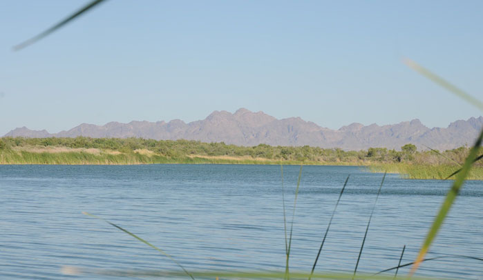
^Cibola National Wildlife Refuge along the Colorado River, looking from the California shore towards Arizona. May 2010.
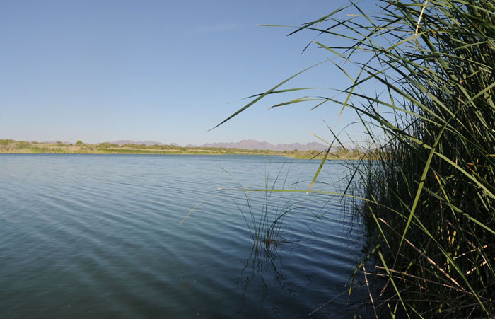
^Colorado River and cattails in Cibola National Wildlife Refuge.
Technology, Sunburn, and Birds
BrightSource engineer Danny Frank flew in from Israel to explain the power tower technology. He has worked for 5 years on the Negev Desert pilot project that BrightSource is scaling up for its California projects.
Frank went into detail about BrightSource's new heliostat technology. They would use the LH2 heliostat, with two mirrors on a pylon. Each mirror would be the size of a garage door, the heliostat 120 square meters. He noted that the Solar 1 and 2 power tower at Daggett had problems with focusing the mirrors.
BrightSource was trying to reduce the amount of radiant heat from the receiver on top of the tower, to minimize heat losses. For a 750-foot power tower there will always be some wind, sending hot air out and above the tower. Depending on winds, heat will radiate out 4 to 40 meters until ambient temperature is reached again. Frank said this means there will be no hot air turbulence. If no wind exists, hot air will rise 40 m straight up.
"I have no idea about the danger to birds. I am a physicist," Frank told the agencies.
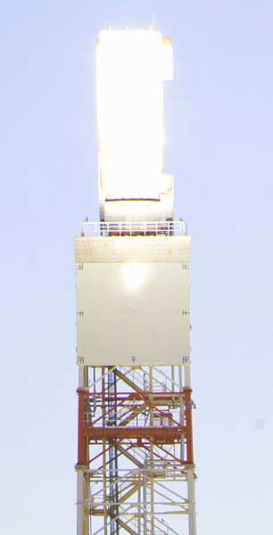 Frank discussed heat or thermal flux: the rate of heat energy transfer through a given surface which in this context is the air in the vicinity of the receiver. The air does not heat up, but energy is transferred and will heat up a body placed in the flux (such as a bird flying through).
We note that heat is transferred in three ways, radiation, conduction and convection. When heliostats focus on a receiver, heat is transferred by radiation from the heliostats to the target receiver, then by conduction through the metal receiver walls to the water or molten salt and by convection (circulation) to the boiler steam drum. The hottest temperatures will not be the surface temperature of the receiver because the circulating fluid is carrying the heat away. The hottest temperature is roughly one inch off the metal surface. The energy from the sun can be measured, the reflectivity of the mirrors and energy transferred to the water or molten salt can all be measured. What is left is the radiant energy or radiant heat flux from the receiver.
BrightSource has a model they developed about trying to minimize the radiant heat from the receiver, and said the flux from the center of the receiver would be 600 kW/square meter for the 750-ft tower on the 250 MW plant, the same that they measure on the receiver of their 6-MW pilot project tower 180 ft tall. 30 feet away the flux would be 200 kW/square meter. 40 feet away it would be down to 50 kW/m2. But winds would make the flux wider on one side.
Frank said at 16 kW/m2 a worker could work for a few minutes at a time with special sunblock, UV resistant shirts, and eyewear. At 50kW/m2 a person can work briefly near the area. Maximum flux allowable on the human eye is 1 to 10 kW/m2. 10 kW/m2 is "no problem" said Frank on skin, as sunburn occurs when 330 Joules/m2 of the sun's energy hits the skin for 6 minutes, or 380 kW/m2.
At the test project in Israel solar field walker once a week walks through the solar field and three times a day walks around the tower. From 2007 to last week Frank said they detected no burned birds, no bird mortality. He sees birds such as pigeons and bulbuls fly through the area.
A bird flying through the air will heat up crossing the concentrated solar beams, Frank explained. A black-colored bird would heat up faster than a white bird.
BrightSource has a new special receiver that would have a smaller, hotter area where more focused solar beams would be directed, than was the case at Solar 1 and 2 in Daggett.
Joel A. “Jeep” Pagel, a biologist with the US Fish & Wildlife Service, pointed out that avian eyes are much more sensitive to a broader spectrum of light than the human eye. They can register ultraviolet light, for example.
Frank pointed out that UV light will be absorbed by the mirrors and not reflected. This part of the spectrum would be dispersed close to the mirror.
Pagel countered that birds might be instantly blinded close to the tower, and that many birds already have a higher body temperature.
Frank said their 6-MW pilot tower in Israel is 180 feet tall with 1,600 heliostats. It has the same maximum flux of 600 kW/m2. BrightSource indicated they are asking an ornithologist at Tel Aviv University to study bird interactions with their test power tower in Israel, but this would take a few years of data gathering.
^Cinnamon teal in flight, summer at Malheur National Wildlife Refuge in eastern Oregon.
Pagel asked a hypothetical: if he were to jump out of a plane 1,000 feet over the tower, and parachute down next to the tower through the solar beams, would he survive? Frank said if he were falling and it took him 2 seconds to pass through the beams, no problem.
Avian and Bat Surveys
A URS contract biologist summarized the surveys done so far.
General bird species surveys were undertaken by using 16 transects during the breeding season (April-May) and non-breeding season (November-December), using the BLM solar protocol point counts (of visual and vocalization observations). One transect was surveyed per square mile. Transects focused in on microphyll woodlands and washes. Horned larks were found, a species on the California Department of Fish and Game watch list: 21 were counted in spring, and these were probably the subspecies which is on the watch list; 114 were found in fall and winter, probably an influx of other subspecies migrating in. A small flock of American white pelicans flew over the project in spring heading north. Low numbers of raptors were counted.
A few nights were spent doing bat surveys in mine shafts in the area, such as the Roosevelt Mine. Bats were found. Bats were also detected during informal monitoring. BrightSource agreed to carry out one year of Anabat acoustic monitoring. A Fish and Wildlife Service biologist commented that radar studies should try to catch pulses of bats migrating through the area.
Burrowing Owls
Burrowing owls were surveyed following the Burrowing owl consortium guidelines, with 100% coverage of the project area. Burrows with sign were monitored. Two incidental sightings of owls were made during other surveys. 17 burrows with sign were found, and each was watched for four days at dawn and dusk for occupancy; none were seen. Preconstruction surveys will be done.
US Fish and Wildlife Service questioned this survey, explaining that a large influx of Burrowing owls migrate in during the winter, from as far away as Canada, to the California desert. So a winter survey is needed.
The agency biologists were also curious about the 17 burrows with sign -- this could be left over from wintering owls using the burrows. More robust data is needed to support a determination of owl occupancy on the site.
The Burrowing owl is a California state sensitive species. When burrows are found, it should be determined if they are occupied by family units or wintering individuals.
Gila Woodpeckers and Elf Owls
US Fish and Wildlife biologists said
USFWS biologists said the Elf owl (Micrathene whitneyi) is found in very similar habitat to the Gila woodpecker, and they use the woodpecker's tree cavities. "We need more surveys." We note that in a 1978 survey, Cal DFG speculated that as few as 20 pairs could occupy California. After this the owl was determined to be declining in California where, in its limited range, it is state-listed as endangered. No birds were detected in California on surveys conducted in 1999.
Eagles
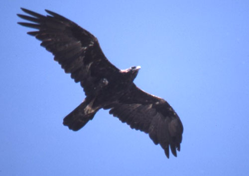
^Golden eagle (Aquila chrysaetos).
The Bald and Golden Eagle Protection Act has been gaining prominence in renewable energy reviews lately as projects are proposed and built further into remote eagle country. The US Fish and Wildlife Service is getting tough recently and enforcing the strict law which does not allow any "take" of an eagle, defined as "kill, harm, or harass." The law defines harassing a foraging eagle out of its hunting territory as a "take" as well. This is unlike the situation for the desert tortoise, which the applicant can obtain a take permit for under the federal Endangered Species Act.
USFWS recently set a precedent in considering issuing take permits for Golden eagles for a wind project in Oregon. A Draft Environmental Assessment was put out to evaluate three alternatives to issuing a permit under the Bald and Golden Eagle Protection Act to West Butte Wind Power LLC. The application by West Butte for a programmatic take permit for Golden Eagles is the first received by the US Fish and Wildlife Service since regulations created this permit type in 2009. See http://www.fws.gov/pacific/migratorybirds/nepa.html
On the project area, for Golden eagles, two helicopter surveys were done in spring 2011 following BLM protocol. No active eagle nests were found, but 4 inactive nests within 10 miles of the project; 2 inactive nests were found at 6.25 miles, one nest at 6.5, and one at 8.5 miles.
Survey protocols to detect eagles are being updated, and the agencies are requesting more data to be able to evaluate mortality potential. Golden eagles will return to nest sites some years, then not use the nest in other years. An eagle might see a power tower as a tall perch from which to scan the surrounding desert to hunt jackrabbits and other prey. Power towers placed in remote deserts such as the Rio Mesa site are unstudied for their impacts on eagles.
Joel A. “Jeep” Pagel of US Fish and Wildlife Service was present at the Rio Mesa workshop. He authored the protocol for breeding season surveys for eagles. Helicopter surveys to count nests are required in a ten-mile radius around the project site, although Pagel said the BrightSource contractor did not do enough surveys for a risk characterization, and flights were too late in the season -- April. They need to be done in March. The purpose of such surveys is to see if eagles are in their territories, they do not nest every year but will occupy a territory. A nest may look empty but eagles may still be using the area. Breeding is based on prey availability. A quick snapshot of nests during a brief helicopter flight will not provide enough data. At least two surveys are needed, Pagel stressed, and one would be lucky to get enough data even then.
Pagel also said surveyors need to be "completely qualified" as they have seen "sketchy results." They have seen surveyors report few eagle territories, then other surveyors go in and find additional territories.
In addition, non-breeding surveys should be carried out to look for resident adults, "floaters," and juveniles. Pagel said we need to know how many eagles are present in an area.
Ground surveys are needed as well, to detect floater individuals waiting to take over a territory. These individuals may even kill an adult to take over it's territory. Ground surveys can find the juvenile eagles which are often missed by helicopter surveys. Pagel recommended at least 2 - 3 years of surveys to detect non-breeding eagles. "We need robust data for this unusual project," he said.
To detect presence of eagles, two survey types are recommended:
1. Long Sits - observers remain in one spot for 1 - 4 hours (up to 8 hours) and scan with binoculars for eagles.
2. Carpet Surveys - if no dense tortoise population is in the area, cameras are set out to record eagles.
Information needs to be gathered about these factors:
1. Habitat loss - is foraging habitat for eagles being lost at Rio Mesa? The botany crew saw two eagles. Are these adults or subadults?
2. Collisions that night happen between eagles and towers.
3. Burn potential, and what the danger zone is. Heat-related injuries are possible, including singing and blinding. There are no studies to date about such tall power towers.
USFWS has developed guidelines for wind projects, and Pagel said his agency will try to modify these for solar power towers.
There is evidence that after large powerline towers are constructed in an areas, eagles will move in and use them as hunting perches.
Bald eagles have also been observed in the area. There is also a concern over other raptors in the area: Ferruginous hawks, Red-tailed hawks, and migratory bird species.
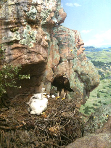
^Golden eagle nest with chicks on rocky cliff.
Environmental Law Requirements Argued
A BrightSource environmental attorney tried to interpret California Environmental Protection Act law to the California Energy Commission, which takes the lead in CEQA review for thermal powerplants over 50 MW. He said these biological studies could "go on forever." CEQA does not require all recommended studies, but just a "sufficient degree of analysis," he said. Studies do not need to be exhaustive, only what is reasonable.
Agency biologists disagreed. They wanted to know more about the potential for bird mortality from the power tower. BrightSource claimed there would be no significant impacts on birds, but they only did two avian surveys. USFWS Biologists had visited the site and found it in their opinion to be upland desert scrub habitat that was not particularly disturbed. "We feel there is not enough data," one said. They told BrightSource that multiple years of eagle surveys were needed.
BrightSource countered that they were being held to a higher standard than other solar projects. Another year of surveys would mean a "very significant delay" in the project, and additional surveys would cost the company $2.6 million.
The Energy Commission responded that they have seen other project proponents overcharged by consultants, and that amount for surveys seemed exorbitant. The CEC biologist said this was a different technology than other projects, and placing it along the Colorado River presented new concerns about bird strikes. The project was near wetlands and in a migratory corridor. "We uphold conservation as our job," one of the biologists said.
BrightSource argued it needed to bring renewable energy in a cost effective manner. The project needed to start commercial operation in third quarter of 2015 in order to fulfill Power Purchase Agreements and agreements to credit committees.
CEC argued back that the magnitude of the impacts in the Riverside County area are such that no one considered them when land use plans were compiled in 2005. The cumulative impacts are huge. Thousands of acres of land will be affected with very little biological information makes decisions difficult. "We are looking at desert ecosystem conservation. We need the appropriate level of data."
Fish and Wildlife Service argued that BrightSource consultants did not follow through with their recommendations for a revised protocol after a November field trip.
More Surveys
At the end of the meeting, the agency biologists and BrightSource tried to iron out differences in the need for more data and more time surveying out on the desert for birds.
No consensus seemed to be reached after BrightSource offered to do survey from February to April at seven locations, twice monthly for migratory birds, and then do an analysis of results to report to CEC, and determine whether more studies would then be needed. If these surveys confirmed the 2011 surveys, then no more would have to be done, went the proposal.
USFWS warned BrightSource that if new information was discovered they risked stopping the clock and having to wait for the following spring for more surveys. The biologists reminded BrightSource that protocol required surveys four times a week, how would their consultants catch pulses of migratory birds at such a low effort. Discussions over this proposal for more surveys would be ongoing.
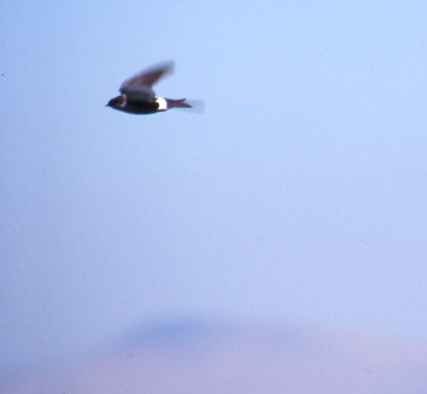
^Violet-green swallow, a songbird protected by the Migratory Bird Treaty Act.
