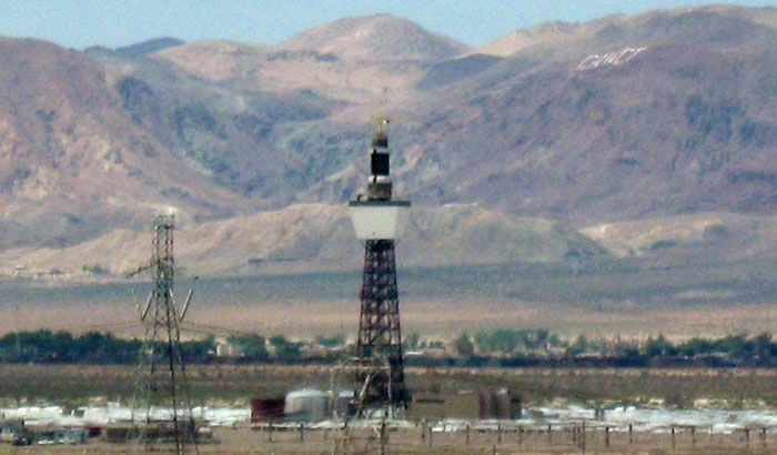
^The Solar 2 power tower earlier this summer at Daggett, California. It was dismantled in late November. The Ivanpah solar project plans on using similar technology, scaled up to larger size with 7 such tower receivers. In the California Deserts the current dozen or so solar thermal projects with applications in represents a mere 4% of the coming applications, CEC told us (see below).
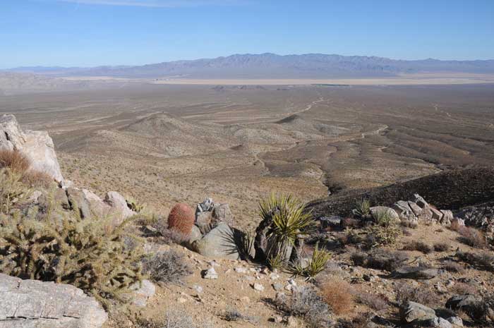
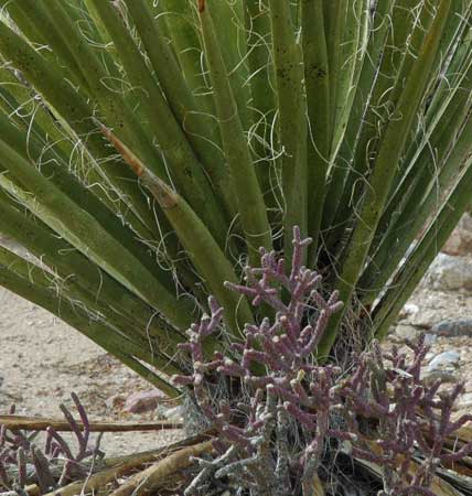
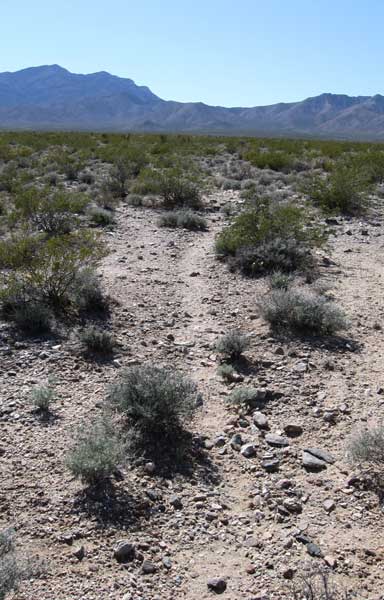
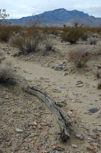
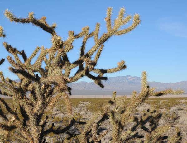
^View looking eastward over Ivanpah Valley, from the foothills of Clark Mountain in Mojave National Preserve, California, December 2009. The proposed ISEGS project would occupy the fan between the hills and playa in the distance. Barrel cactus, Mojave yucca, and Buckhorn cholla grow on the slope of the foreground. The McCullough Range with a wilderness area on it lies on the horizon in Nevada.
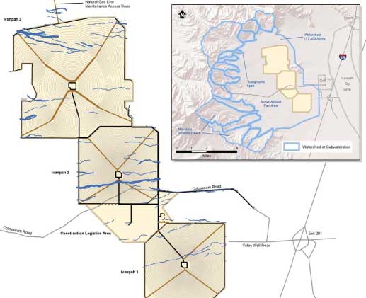
The Project
The Ivanpah Solar Electric Generating System (ISEGS) project is a proposal
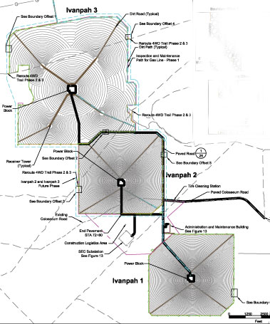
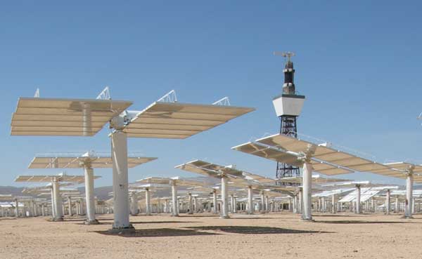
to construct a 400 megawatt (MW) concentrated solar power tower, thermal-electric power plant. It would be built on approximately 4,073 acres (6.4 square miles)(but see below, they want more) of Mojave Desert public land about 5 miles southwest of Primm, Nevada in San Bernardino County, California. The project would be constructed as three individual power plants that share a common administration building, and a shared construction logistics area. The solar power tower project would include installation of 214,000 heliostats (with mirrors) surrounding the power towers. Each of the three power plants would contain a power block with a steam turbine generator. Dry cooling towers would be used to cool the steam cycle. Generator interconnection lines would tie each power plant into a new substation and the Southern California Edison transmission lines passing through the project boundary, which would have to be upgraded to a larger size. The project design would result in the construction of 7 power towers: two power towers 312 feet in height, 5 power towers 459 feet in height, and 3 boiler stacks 131 feet in height.
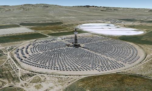
>Daggett Solar 2 power tower (Courtesy Google Earth).
Each heliostat would have two mirrors, each 7.2 feet high by 10.5 feet wide, mounted on 6-inch diameter pylons, with a total height of 12 feet. Cables connecting each heliostat that transmit information to the controller, would be strung above ground. The mirrors track the sun throughout the day and reflect sunlight onto the receiver atop the central tower. Mirrors would be washed every two weeks on a rotational basis. Washing would utilize water accessed from the groundwater supply wells, following treatment in a water treatment system. Washing would be done using a truck-mounted pressure washer, and use 42.7 acre-feet per year.
Without constant cleaning, the Daggett Solar 2 power tower heliostats degraded in quality as the mirrors became sand-blasted. This ended up reducing the efficiency of the system, and it produced less electricity than hoped (Romero-Alvarez and Zarza 2007). Developers wanting to build these delicate systems in the harsh desert may not be taking this into consideration.
On page 6.9-24 of the document, we learn more about the fragility of the mirrors: "An estimated mirror breakage rate of 0.1 mirrors per year likely much more (possibly in the thousands without mitigation and up to 50 with mitigation). The AFC [Application for Certification] states that broken mirrors would be replaced annually by one repair truck. However, the mirror repair activity would likely require several trucks. The AFC states that other repairs and security checks would be performed daily by one truck."
"Mirrors would cover a large proportion of the land surface and, during precipitation events, would be placed in the flat horizontal position" (page 6.9-24). In other words the plant would have to be shut down during cloud cover
BrightSource claims it has a way of "lightly" impacting the desert, not grading the entire 4,000 acres of all plant life, in a "Low-Impact Development" design. What does this involve? The vegetation that could "interfere with mirror movement to a height of 12 – 18 inches" would be clipped and pulped (page 1-9 in the FSA/DEIS).
Creosote may stump-sprout after cutting, but could die after repeated cuttings. Many other shrubs present on the desert fan are adapted to dispersing by seed, and are killed by cutting at this level. We doubt that this treatment will result in "light" impacts to the Mojave Desert scrub habitat, but will severely alter it and destroy much of it.
 We are not sure what fire fuel management policy the company has in mind for all this potential dying vegetation.
Weedy successional growth will most likely grow as mirror wash-water falls to the ground during bi-weekly washing. In cooler seasons this would probably result in the increased growth and spread of invasive Red brome grass (Bromus madritensis ssp. rubens), an annual from Europe that favors disturbed ground, as well as various introduced mustards (Brassica spp.). In the summer it would likely be Arabian splitgrass (Schismus spp.).
To take care of this secondary problem, BrightSource will carry out a weed management policy and apply "soil binders and weighting agents to minimize dust accumulation on the mirrors and fugitive dust as could occur by wind or vehicle traffic" (page 1-9).
<Creosote flowers and seeds.
Managing weeds will include using herbicides, not a "green" method of using the desert. How much herbicide will accumulate over the years of operation, and will any get into the groundwater?
Soil binders are, in fact, made from petroleum products, which raises the issue of how much carbon this "clean" energy plant will be eliminating in the total balance.
The sunlight would be reflected to the receiver boiler on top of each tower. In each plant, one Rankine-cycle reheat steam turbine receives live steam from the solar boilers and reheats steam from the solar reheater. The solar field and power generation equipment would be put into operation each morning after sunrise and insolation build-up, and shut down in the evening when insolation drops. Superheated steam would be conveyed by above-ground pipelines.
<The heliostat arrays around the 7 towers: like having 7 Daggett Solar 2 plants (From the Final Staff Assessment and Draft Environmental Impacts Statement).
Each solar power tower would be a metal structure. Federal Aviation Administration-required lighting and a lightning pole would extend above the top of the towers approximately 10 feet.
The receiving boiler is a traditional boiler on top of the power tower. The boiler converts the concentrated energy of the sun reflected from the heliostats into superheated steam a temperature of 550 degrees Celsius.
Not well-described in the FSA/DEIS: "Two concrete-lined holding basins of about 40 feet by 60 feet are included in the power block area. They can serve for boiler commissioning and emergency outfalls from any of the processes" (From: CH2M Hill. 2008. Supplemental Data Response Set 2D. Revised Draft Biological Assessment, pdf at www.energy.ca.gov >>here). Are these still a part of the project design?
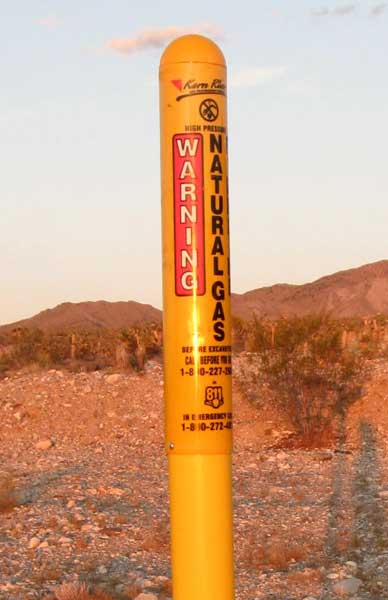
NATURAL GAS PIPELINE
The solar heat used in the boiler process would be supplemented by burning natural gas to heat a partial load steam boiler when solar conditions are insufficient. Each power plant within the project would include a small natural gas-fired start-up boiler to provide additional heat for plant start-up and during temporary cloud cover. Natural gas would be supplied to the site through a new, proposed six-mile long distribution pipeline ranging from 4 to 6 inches in diameter.
Natural gas would be obtained by the
construction of a new 6-mile-long, 4- to 6-inch distribution pipeline from the existing Kern River Gas Transmission pipeline located approximately 0.5 mile north of the Ivanpah 3 site. The primary method of construction includes excavation of an open trench about
36 inches wide and 3 to 10 feet deep, depending on the site-specific soil type. With loose soil, a trench up to 8 feet wide at the top and 3 feet wide at the bottom may be required. The temporary
construction disturbance area for the natural gas pipeline would be a 200-foot by 200-foot area required for the KRGT tap point. (From: CH2M Hill. 2008. Supplemental Data Response Set 2D. Revised Draft Biological Assessment, pdf at www.energy.ca.gov >>here)
Again how much carbon are we offsetting?
ACCESS AND MAINTENANCE ROADS
Coliseum Road, currently a dirt road used by recreationists, would be paved to a 30-foot wide, two lane road for a distance of 1.9 miles from the Primm Valley Golf Club to the facility entrance. The road would be re-routed around the southern end of Ivanpah 2 before re-joining the current road to the west of the proposed facility. But two other dirt roads used by recreational users would be blocked and re-located outside of the project boundary fence.
Within the heliostat fields, 10-foot wide maintenance roads would be established concentrically around the power blocks to provide access for heliostat washing and maintenance. The roads would be established between every other row of heliostats. The applicant estimates that 100 heliostats can be washed per hour with 4 trucks working 10 hours per night at about 0.4 mile per hour. 158,285 linear feet of new heliostat maintenance would be graded into creosote-bursage-cactus-yucca desert (page 6.2-61). An additional maintenance road would be established on the inside perimeter of the boundary fence. Within each unit, a diagonal dirt road would be established to provide access to the concentric maintenance paths and the power blocks. Some of these would be gravel.
Details of the grading we could not find in the FSA/DEIS, but they are available on other documents: "To construct the heliostat array fields located within these sites, some vegetation clearing and site grading would occur. In areas where general site grading is not required for stormwater management, vegetation clearing and grading would be performed only between every other row of the heliostat arrays that radiate outward in concentric arcs from their associated receiving towers. The cleared rows would serve as access routes from which the heliostat mirrors can be reached from both side of the road for service and cleaning, thus minimizing soil disturbance within the heliostat array fields. It should be noted that a minimum amount of cutting and filling within these access routes is anticipated. Some re-grading for maintenance would most likely be required due to soil erosion and regular use" (From: CH2M Hill. 2008. Supplemental Data Response Set 2D. Revised Draft Biological Assessment, pdf at www.energy.ca.gov >>here)..
An “Irish Bridge” or low-water crossing would be constructed where permanent asphalt paved access roads cross major ephemeral washes on the site (CH2M Hill 2009l). These bridges would be constructed of reinforced concrete or gabion baskets, would generally conform to the cross-sectional dimensions of the channel, and are being designed to prevent the scour and washout of major asphalt access roads during storm events (CH2M Hill 2009l). When necessary, offsite stormwater drainage would be collected using a system of swales, berms, and existing ephemeral washes to control and direct stormwater through and around the ISEGS site (CH2M Hill 2009). (page 6.2-60)
Those who complain against off-road users on the desert need to consider this huge increase in roads by solar thermal companies.
FENCING
The project area would be surrounded by security fence, which would be constructed of
8-foot tall galvanized steel chain-link, with barbed wire at the top as required. The
security fence would surround the outer perimeter of each power plant, the substation,
and the administrative complex. Tortoise barrier fence would also be installed in
accordance with the Recommended Specifications for Desert Tortoise Exclusion
Fencing (USFWS 2005). The tortoise fence would consist of 1-inch horizontal by 2-inch
vertical galvanized welded wire. The fence would be installed to a depth of 12 inches,
and would extend 22 to 24 inches above the ground surface and integrated with the
security fence.
So much for BLM's main mission, the management of public lands for multiple use.
Another question is how these fine-mesh tortoise fences will act as barriers to flood debris allowed to flow in washes through the project (see below). Will tortoise fences act as dams, collecting gravel, cobbles, and branches, eventually changing the flows of these washes? Will floodwaters overbank their channels, causing damage to fences and other structures? The hydrology could become a mess here. Those of us who live in the desert know that the infrequent yet strong flash floods in the desert easily take ill-conceived down fences.
TRANSMISSION SYSTEM INTERCONNECTION AND UPGRADES
"In order to accommodate the total anticipated 1,400 MW load generation by ISEGS and
five other planned renewable energy generation projects in the region, the California
Independent System Operator (California ISO) has identified approximately 36 miles of
transmission line within California and Nevada that would need to be upgraded from
115 kV to 220 kV" (page 1-7).
DECOMMISSIONING
 After the (highly theoretical and optimistic) 50-year lifespan of the project, the owner would close the plant. Facilities would be removed to a depth of 3 feet and the ground graded to "original contours" (page 1-10). But concrete, piping, and other materials existing below three feet in depth would be left in place.
That is a lot of trash to leave in our desert.
>Mojave yucca (Yucca schidigera) and Pencil cholla (Cylindropuntia ramosissima) on the site.
Supposedly cacti and yuccas species would be salvaged prior to construction, transplanted into windrows, and maintained for later transplanting following decommissioning. Unless the company waters them vigilantly, these plants often die in our experience. Yuccas especially are difficult to transplant.
"Shrubs and other plant species would be revegetated by the collection of seeds, and re-seeding following decommissioning." But how much herbicide residue will remain in the soil to prevent their sprouting?
Land Use - They Want Even More
The Final Staff Assessment/Draft Environmental Impact Statement states: "The applicant’s proposed increase in heliostat mirror surface area associated with the Optimized Project Design led the applicant to also propose an increase in total ISEGS area of about 300 acres and extension of the project boundaries of the three power plants by 250 feet along each perimeter...a portion of the increased heliostat surface area to be licensed ensures that the project will be able to meet its contractual output requirements even if the solar resource is less than forecasted. The final rows of heliostats may not be necessary. Pending the results of actual performance during plant operation, a decision will be made on whether or not to install the additional heliostats" (page 3-6).
And more land: "In addition to use of the proposed right-of-way area, the applicant proposes some project-related activities to occur outside of the project fence, on land not included within the proposed right-of-way area. These would include inspection and maintenance of the fence, underground utility repairs, maintenance of drainage systems, and possible installation of new stormwater drainage systems. In addition to these activities, a roadway would need to be maintained outside of the project fence to allow vehicle and equipment access for these activities" (page 1-6).
So after public comments are taken, after the environmental review process, and after the plant is built and begins operation, BrightSource wants the option of more public land. The FSA/DEIS does not state whether this would trigger a new environmental review process, or whether this land is cryptically included in the present decision.
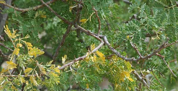
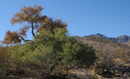
^Catclaw acacia (Acacia greggii) showing fall colors in October. The small wash trees are deciduous during the winter.
The land use plan affecting this project is the BLM’s California Desert Conservation Area (CDCA) Plan of 1980, which will have to be amended to include this project. "Impacts of the ISEGS project would also combine with the potential impacts of reasonably foreseeable renewable energy projects in the southern California Mojave desert to result in significant and unmitigable regional cumulative impacts related to land use" (page 6.5-1).
CEC and BLM admit that the project would not conform with San Bernardino County's General Plan Conservation and Open Space Elements.
San Bernardino County Supervisor Brad Mitzelfelt recently said the Ivanpah Valley project site should be protected, as it is pristine desert habitat that is home to several endangered species. The county was concerned that the project would monopolize too much desert tortoise habitat. When a project affects desert tortoise habitat other land has to be set aside for tortoises. That means either buying private land or putting more restrictions - such as banning off-roading - on existing public land. If the project were built elsewhere - not in a tortoise habitat - the Ivanpah Valley land could be set aside to make up for land lost to other projects.
In a statement, Mitzelfelt said the project would use San Bernardino County resources but likely wouldn't provide jobs or power for the county.
"This project would create jobs for mostly Las Vegas and electricity for mostly San Francisco at the expense of Southern California's Mojave Desert," Mitzelfelt said (from the San Bernardino Sun >>here).
Specifically San Bernardino County's General Plan calls for preservation of scenic vistas in the County. The project would have adverse effects on scenic vistas. The county also wants to maintain and enhance the visual character of scenic routes. The plan says:
“Development along scenic corridors will be required to demonstrate through visual
analysis that proposed improvements are compatible with the scenic qualities
present.” The visual analysis of the project found that it would not be compatible with
the scenic qualities present in the viewshed of portions of Highway I-15 designated
as a County scenic route.
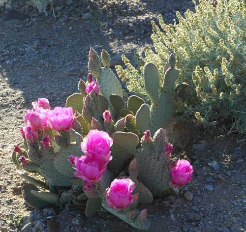
<Beavertail cactus (Opuntia basilaris) in bloom, and Bursage (Ambrosia dumosa), spring.
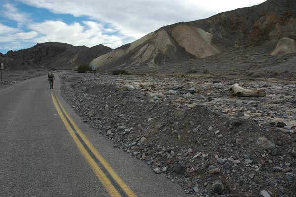
Recreation will be affected (removed) in the project area. On page 1-26 CEC and BLM try to claim no recreation occurs in the area: "The proposed project location itself is not specifically permitted, used, or designated for any recreational activity." This is not true: three OHV trails directly cross the project footprint and will have to be re-routed. One dirt road (Coliseum Road) accessed Clark Mountain in Mojave National Preserve. The area has been used for hiking, bird-watching, and people coming to view the Clark Mountain burro herd.
Then the document contradicts itself: "A variety of recreational activities occur on public lands in the proposed project area. These include auto touring, backpacking, biking, camping, climbing, hiking, horseback riding, nature walks, star gazing, wilderness areas, and wildlife viewing. In addition, sightseers, painters, and photographers are drawn by spring wildflower displays, and year-round bird-watching. Clark Mountain, managed by the Mojave National Preserve (MNP) located within a few miles to the west of the proposed project location provides rock climbing, hiking, hunting, and wildlife viewing" (page 6-18.3).
 "The proposed project would contribute incrementally to the long-term reduction of outdoor recreation quality available in the Ivanpah Valley area of the California Desert due to the cumulative effects of development leading to a transformation from a natural setting to a more industrial setting" (page 6-18.2).
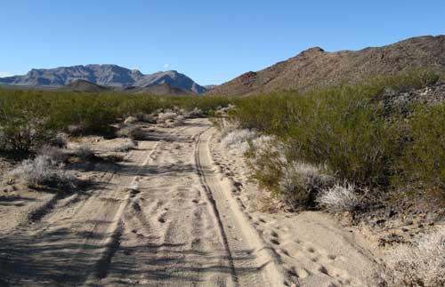
>Dirt road used for recreation along the metamorphic hill on the east side of the project site; it would be closed off. We would rather have this than 4,000 acres of multiple roads and scraped land.
The ISEGS project is just the tip of the iceberg, as more massive land-consuming solar thermal and photovoltaic projects are planned for Ivanpah Valley (see our coverage of the NextLight Silver State projects on the east side of the valley >>here). (See Cumulative Impacts, below.)
The proposed project would require re-direction of access roads to recreation areas. The area has been driven by recreationists seeking an "unspoiled desert viewscape." "The impact on the quality of outdoor recreational experience would diminish the experience of
campers, hikers, hunters, and other recreational users" (page 1-26). CEC and BLM conclude that impacts will not be significant (an opinion).
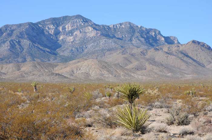
^Clark Mountain in Mojave National Preserve is a recreation destination. Seen from the ISEGS site on the bajada with Creosote and Mojave yucca.
Cultural and Archaeology
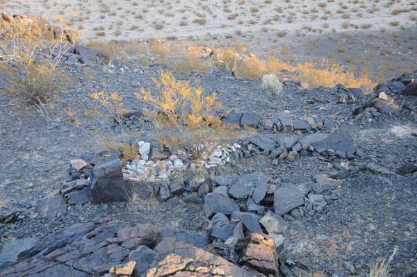
<An old trail through Creosote-Bursage crosses the middle of the project site. This could be a prehistoric trail from Clark Mountain to the playa.
Previous surveys in the region, including Ivanpah Valley, have found evidence of prehistoric use: campsites, lithic scatters, ceramics, rock shelters showing sign of habitation, trails, and agave roasting pits. These range from the valleys and mountains. Open temporary campsites as well as more permanent camps have been found in the valley zone, as well as chipped stone artifacts, ceramic scatter, and a trail. Surface artifacts and features may range from 4,000-years old to recent.
Three rock shelters are in the area, one just above the project site at the base of Clark Mountain. One has milling stones. Grass seeds were probably eaten, as well as pine nuts from the local Pinyon groves in Clark Mountain and other surrounding ranges. The playa edge provided other resources when it held water periodically. The local Clark Mountain agave (Agave utahensis var. nevadensis) stands in the hills provided a rich root-food that was roasted in pits (see our hike in Stateline Wilderness, a mile north of the project site >>here).
On the actual site an obsidian flake and nodule, and a chert biface (all of rock not from the region) were found, as well as historic mining debris, pits, and a horseshoe. Three apparently prehistoric rock shelters were found on the small limestone hill in the northern part of the project area, as well as rock walls and cairns on both this hill and the larger metamorphic hill. Cairns may be of both Native American and miner in origin.
In a sad commentary on how special this area is, during geoarchaeological studies observers found patches of very stable old bajada, bypassed by flood washes and ground disturbance. "A subfossil piñon log (Pinus monophylla) was found on a more recent bajada surface among recently active ephemeral streams. The log is thought to be anywhere from 1,100–3,400 years old and may date the surface on which it was found to that approximate age. This information and the recent inadvertent discovery of an intact historical archaeological site (Temporary field no. ISEGS-02) approximately 1,700 feet to the east of Ivanpah No. 2... demonstrates that, although the bajada is subject to a geomorphic regime of net erosion, the landform provides enough stable surface patches to preserve a representative sample of the historical archaeological deposits that would reflect historic activity on the bajada" (page 6.3-40 on our hard copy of the FSA/DEIS, and page 4.12-42 on the digital cd version).
This is "old growth Mojave Desert scrub" and we found ancient creosote rings also indicating stable land surfaces. These creosote grow clonally outwards in a ring, and may be thousands of years old. This area should not be scraped!
A strange "enigmatic" geoglyph (ISEGS-01) was found next to the metamorphic hill on a small hill next to the middle of the project site (page 6.3-50 hard copy). We visited the place in early December, and our photos accompany this page. After consultation with various experts and research on the site, comparing it with other archaeological sites, the BLM and CEC think it is prehistoric. It lies on a ridge, and has five stacked rock features, some like small terraces on either side of the ridgeline. Three stone "niches" were built by them, and one part of a "bench" is filled with white quartz, making quite a contrast with the blackish metamorphic rocks around it. Near the terrace complex is an odd triangular rock-wall feature filled with angular cobbles. The quartzite was apparently taken from a vein about 90 feet to the south, in an area that was dug out by mine prospectors. The quartzite from the feature seems more weathered, and may have been collected prior to the vein was opened by miners. No metal was found.
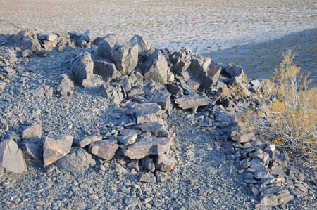 BLM/CEC seem quite intrigued with this archaeological find, and want to know more about it than BrightSource's archaeologists give in their analysis. They conclude that it could be related to some symbolic ritual activity, possibly related to Southwest agricultural users.
We find it amazing that they would go ahead and license the solar project before fully determining the significance of this site and possible surrounding land use. The archaeological feature would not be destroyed by the project, but it lies within a few hundred feet of the edge of one of the heliostat fields.
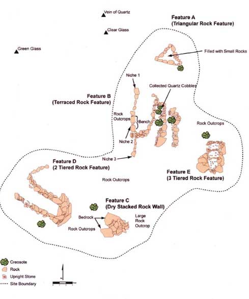
^Plan of the ISEGS-01 geoglyph, from the FSA/DEIS.
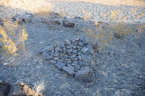
^The triangular filled rock feature.
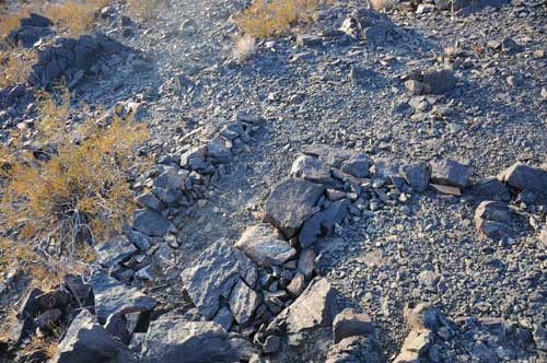
^On our site visit, we examined the archaeological site. Here are the small terraces on the west side of the ridgeline. The areas in between the rock alignment-walls appear tamped down. They are only a few feet in length. Some geoglyphs in Panamint Valley, Inyo County, California, to the northwest of Ivanpah Valley, show tamping of the ground that may be from dancing. Or perhaps these walls were built to catch water for a ritual.
^Quartzite rocks piled into one terrace. Panamint Valley geoglyphs also sometimes have piles of white quartz rocks integrated with the design.
The FSA/DEIS admits: "Construction of the solar and wind projects proposed throughout this region would result in substantial changes in the setting and feeling, and association of the areas in which they are constructed. The current design of these projects would result in a significant cumulative impact to the region. Within the desert region there are numerous traditional use areas, and lands sacred to Native Americans are present. Potential impacts would include physical disturbance or alteration directly as a result of construction activity or diminished visual character of traditional use areas due to the presence of industrial structures. If impacts to traditional use areas would occur at any individual site, mitigation would be implemented to minimize project impacts; however the potential for vast disturbance of the desert would potentially lead to a loss of resources and impacts to visual character, thereby resulting in a significant cumulative impact. (page 4.12-72 in the digital version, page 6.3-71 hard copy).
Water and Soils
^Large wash in the middle of the site, with Desert almond (Prunus andersonii), a bush that roots into underground water flows. Notice the small woody debris caught on it from a flash flood. The metamorphic hill and playa are in the distance.
STORMWATER MANAGEMENT APPROACH
The proposed project site is located on an alluvial fan that acts as an "active stormwater
conveyance" between the Clark Mountain Range to the west and the Ivanpah Dry Lake
to the east. Widespread bajada flooding events and sheetwash deposition was noticed by surveyors. A total of 1,973 ephemeral washes were mapped on the project, 16 being "category 1= 36 to 85 feet wide." BrightSource wants to build a delicate project where each mirror must be configured exactly using computer precision so that sunlight beams will hit distant tower receivers -- any deviation could cause damage to the tower -- on an active floodwash fan with anastomosing channels that move over time unpredictably.
The applicant’s proposed stormwater design and management system is a "Low-Impact Development design" which "attempts to minimize disruption to natural stormwater flow pathways." This involves minimizing the areas of direct removal of vegetation, minimizing the areas of grading and leveling, and minimizing the amount of active management of stormwater in engineered channels, ponds, and culverts.
But the amount of grading would still be enormous: "Even with these LID methods employed, project development would likely have effects that result in reduced storm water infiltration and increased runoff. Although grading would be minimized to the extent necessary, the project would still cut, move, and reuse approximately 135,000 cubic yards of soil ... in a 170-acre area of Ivanpah 3. An additional 110,000 cubic yards would be cut and moved through the remainder of the project. To minimize these impacts, all soil cut would be reused onsite. In addition, the applicant estimated that approximately 412,600 cubic yards of vegetation would be cut, mulched, and used in erosion control. Vehicles used in the development of the site and ongoing operations after construction is complete would include: a skid mounted, 23,500 pound (lb) GT-25XP Gyro Trac for mowing vegetation; a 48,000 lb Caterpillar 550 Wheel Harvester modified to be a heliostat mirror washing vehicle that could pull a 500-gallon water tank; a 47,000 lb sonic heliostat poleinstaller; golf cart sized utility vehicles; and a 60,126 lb Grove 540E crane for heliostat mirror installation" (page 6.9-13).
 "Satisfactory completion of the heliostat pole installation testing by the applicant to either confirm or update its current installation plans followed by further evaluation by staff of whether there would be any impacts related to the method of construction or failure of the heliostats due to storm water flows" (page 6.9-2 digital copy)."The applicant is currently designing and evaluating methods of post installation and heliostat construction. The results are not available for this analysis, but are expected to be submitted to staff at a later date" (page 6.9-14). The public is not able to review how the applicant will install the heliostats to withstand flooding until after the project is approved? This is not acceptable. They may try to pound in the poles deeply using a truck-mounted sonic driver, but we do not know.
The document says, "staff considers that the proposed project does constitute an unusual circumstance. The proposed project is of a very large scale compared to other projects constructed on active alluvial fans in the past. Although modeling and calculations can be used in an attempt to estimate future scenarios and provide a basis for structural design parameters, these methods are based on assumptions and projections that are
imprecise and untested in this environment. Should these assumptions and calculations be inaccurate, the consequences of flash flood damage or modified sedimentation and erosion rates may be significant" (page 6.9-19). BLM and CEC recommend mitigation and minimization measures that they hope will alleviate these worries (we are more doubtful).
CEC and BLM do seem to understand the consequences of allowing flooding through the project: "Using the concept of low impact development, there would be no storm water diversion or detention systems to divert storm water away from the heliostat fields or to reduce the velocity of storm water as it enters the fields. Because the heliostats would be mounted on poles, which would be driven into unconsolidated sediments on the alluvial fan, general erosion, migration of channels, and local scour caused by storm water flows could remove sediment supporting individual poles and cause them to fall to the ground. Once on the ground during a storm event, the broken glass associated with the mirrors could further break and be transported downstream. Also, the heliostat structure itself and the associated wiring, could be transported downstream. Although the security fence located on the downstream side of the proposed project area could stop larger pieces from leaving the property, it would not stop small glass fragments. Also, the fence itself could be threatened by storm water flows and could not guarantee the onsite capture of all damaged materials" (page 6.9-27).
Looking at the quiet desert landscape it can be easy to underestimate the violence of a summer thunderstorm or El Nino winter flood. We have witnessed storm cells in Death Valley cause huge flash floods that have moved car-sized boulders down mountain canyons and destroy small buildings. The 2004 flood in Furnace Creek Wash dug out a new channel, took out the highway, and unfortunately caused the deaths of a few tourists who attempted to drive through the water loaded with moving boulders. (See Surprise Canyon for more on a large flood event in the desert.) Even floods that do not move large debris can damage structures over time with the slow build-up of sand, gravel, stones, and logs, against fences, bending them down.
Recent paleoclimatological studies measuring high stands of lakes in desert playas and flows in desert rivers, such as the Verde in Arizona, have shown that the "statistics if extreme flows derived from twentieth century records are not representative of all hundred-year episodes of the past 1,400 years,...information of value for engineering applications as well as ecological understanding" (Redmond 2009:23). This is critical: in our lifetimes we may not have even seen the largest flood events that could occur in the desert. Historical records of rain in Ivanpah Valley cannot be used as predictors of future weather.
Not satisfied with BrightSource's own flood studies, CEC and BLM contracted their own independent study, and what they discovered was not what BrightSource wants to hear: "To evaluate the potential for heliostat failure and downstream transport, staff conducted
a local scour analysis of the potential impact of storm water velocities on individual
heliostats (AECOM2009a). The analysis concluded that the scour from a 10-year storm
could lead to the failure of more than 4,000 heliostats and more than 32,000 from a 100-
year storm. The applicant has not conducted a direct calculation of the number of at-risk
heliostats. However, staff has estimated the number of at-risk heliostats based on the applicant’s calculated storm water velocities, and the number could be more than
20,000 in a 100-year storm" (page 6.9-27-28).
 >Flash flood damage in Surprise Canyon, Panamint Mountains, California: rocks and uprooted trees battered down a metal gate.
In a very surprising statement, the FSA/DEIS reveals: "Up to six to nine feet of scour can occur at the project site. To test the potential effects of storm water flows and scour on the heliostats the applicant recently (August 2009) attempted to install and conduct load tests on heliostat poles. During this test, problems occurred where large rocks were encountered causing installation refusal and drilling equipment breakage and malfunction. The testing did not demonstrate poles could be installed at depths satisfactory to mitigate potential scour and failure. Satisfactory completion of heliostat pole installation testing by the applicant is necessary so staff can confirm the proposed method of installation is adequate to install the heliostats at a depth sufficient to mitigate failure and that there would be no impacts related to other methods of installation. Condition of Certification SOIL&WATER-5 requires the heliostats to be reinforced to withstand up to six feet of scour. In addition, this condition requires the applicant to develop a Stormwater Damage Monitoring and Response Plan, which would include a plan to cleanup and mitigate failed heliostats. By requiring reinforcements of the heliostats, the estimated number of heliostat failures during a 10- year storm event would be reduced to approximately 10. During a 100-year event, this number would be reduced to approximately 50" (page 6.9-28). We also note that reinforcing heliostats in this manner will increase construction costs.
The FSA/DEIS says that a "Drainage, Erosion, and Sedimentation Control Plan has been developed to mitigate the potential storm water and sediment project-related impacts. However, the calculations and assumptions used to evaluate potential storm water and sedimentation impacts are imprecise and have limitations and uncertainties associated with them. Given the uncertainty associated with the calculations, the magnitude of potential impacts that could occur cannot be determined precisely" (page 1-27). The project could impact recreational use of Ivanpah Playa as well as tortoise habitat. "Should these impacts occur, they would likely be highly controversial."
We still do not understand how gravel, rocks, and woody debris will be allowed to "pass through the site in an uninterrupted manner" (page 6.9-26), when fencing around the project will include a tortoise exclusion fence consisting of 1-inch horizontal by 2-inch
vertical galvanized welded wire installed to a depth of 12 inches, and extending 22 to 24 inches above the ground surface and integrated with the security fence. This will surely cause debris dams.
To be certified, CEC/BLM is requiring BrightSource to "ensure that all heliostats are designed to withstand storm water scour of up to 6.5 feet or greater as estimated by a
Pylon Insertion Depth and Heliostat Stability Report to be completed by the applicant. The project owner shall also develop a Storm Water Damage Monitoring and Response Plan to evaluate potential impacts from storm water, including heliostats that fail due to storm water flow or otherwise break and scatter mirror debris on to the ground surface" (page 6.9-55). This includes "documenting and restoring" the Ivanpah Playa surface should any broken mirror fragments be washed down.
Other requirements are inspecting and repairing damage and buildup of sediment or debris on the tortoise exclusion fence, inspect for heliostat "tilting, mirror damage, depth of scour compared to pylon depth below ground and the Minimum Depth Stability Threshold, collapse, and downstream transport. Drainage channels would be inspected for substantial migration or changes in depth, and transport of broken glass."
CEC/BLM may allow " design modifications to address ongoing issues. This may
include construction of active storm water management diversion channels and/or detention ponds."
"For activities outside of the approved right-of-way, the applicant will notify BLM and acquire environmental review and approval before field activities begin." This is unfair to the public -- if BrightSource wishes to completely redesign its flood control plan for the entire project (in its approved right-of-way) because it did not foresee the active nature of this fan, a new environmental review process should be initiated. And if giant berms, diversion channels, and other artificial flood control projects are going to be built outside of the project right-of-way, then this is just another cumulative impact on the valley, as more public land will be graded, more tortoises moved, more rare plants destroyed.
"The project owner shall prepare an annual summary of the number of heliostats failed, cause of the failure, and cleanup and mitigation performed for each failed heliostat." (Pages 6.9-55-56)
"The applicant must monitor site precipitation continuously and keep a record of storm events that produce more than 0.5 inch of precipitation at the site. During storms and/or within one business day after each 0.5 inch of precipitation from a storm event, the applicant must visually observe and document observations of storm water discharges from the site" (page 6.9-87).
CEC/BLM require almost impossible feats of control from the project workers during operation: "Forty-eight (48) hours prior to each potential storm event, the applicant
must visually observe and implement appropriate corrective action for: ...all storm water drainage areas, to identify any spills, leaks, or uncontrolled pollutant sources, ...any storm water storage and containment areas" (page 6.9-88). Workers must also collect water samples after storms and analyze their water quality and report to the Lahontan Regional Water Quality Control Board.
Furthermore: "Soil erosion and loss of soil due to project activities could be substantial and would need to be mitigated. The proposed erosion and sedimentation control measures include: preserving the existing vegetation to the extent possible; wetting or using soil binders or weighting agents active construction and laydown areas; controlling speed on unpaved surfaces; placing gravel in entrance ways; and use of straw bales, silt fences, and earthen berms to control runoff" (page 6.9-21).
"Other long-term effects on vegetation would include soil compaction, shading of the sun
beneath the heliostats, and changes to the soil structure by use of dust suppressants" (page 6.9-25).
^Map showing stormwater drainages through the site. (From the FSA/DEIS)
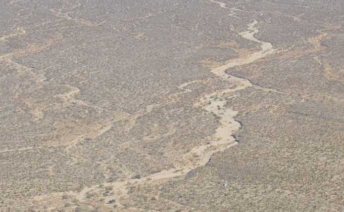
^The large active wash as it goes through Ivanpah 2, as seen from the Clark Mountain foothills.
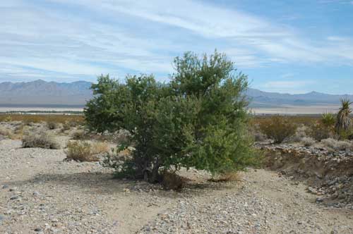
^Large wash through ISEGS 1, with Catclaw acacia. These wash trees are phreatophytes, specializing in sending strong taproots deep down into the substrate -- some phreatophytes in the desert have roots 100 feet deep to withstand floods. They are going to put mirrors in this wash?
^Wash winding through Ivanpah 2 project site in creosote and bursage.
<Pine log debris in a wash on the project site. This came down in a flood from woodlands high up on Clark Mountain miles uphill.
GROUNDWATER USE
The facilities would require pumping groundwater from a new well for "make-up water" for the steam system it evaporates from the dry-cooling process, and wash water for the heliostats, as well as potable water for domestic water needs. Approximately 16,000 gallons of water per night would be used for mirror washing (that would be almost 6 million gallons per year if trucks ran every night, 18 acre-feet, although BrightSource seems to need more as elsewhere they say they need 42.6 acre-feet per year for washing).
The applicant estimates project water consumption would not exceed a maximum of 100 acre-feet per year.
But BrightSource doubled the proposed number of mirrors on each heliostat and changed the mirror array fields from what was originally proposed, and then wanted more water. CEC and BLM were not pleased with this new demand: "Although this change increased the total surface area of all the mirrors combined by approximately 61.4 percent, the applicant has stated that the project’s water demand would not exceed 100 AFY. The applicant has also stated during workshops that they would like to have the water supply metered on a five-year rolling average. Staff believes such an average is too uncertain in an environment where water supply is quite limited and when project engineers can reasonably estimate the volume of water that would be required for the project’s construction and operation" (page 6.9-28). CEC/BLM ask that BrightSource places meters on its wells to verify it is not exceeding 100 afy.
In a very circuitous argument BLM and CEC conclude that impacts to the groundwater supply and quality would be "less than significant." Precipitation recharge in this basin is low: the Environmental Protection Agency, when analyzing the Ivanpah Valley Aquifer for the Coliseum Mine in the 1990s, was concerned about overdrafts from any water extractions, as the annual recharge is so small (only 800 acre-feet per year) (Reference: http://epa.gov/waste/nonhaz/industrial/special/mining/techdocs/gold/goldch3.pdf).
BLM and CEC quote two different groundwater studies from the that estimate 1,275 and 1,607 acre-feet per year of recharge, two other studies from 2000 that range from 2,845 to 5,800 afy, and a study in 2008 that estimated 2,806 afy. Conveniently, a study done by the applicant and another by CEC recently estimated a high of from 5,223 to 6,200 afy. No surprise here, those with most at stake found the most water to use. (As an aside three of the studies are missing in the references.)
Primm Valley Golf Club near the site uses 1,741 acre-feet per year, and the town of Primm, Nevada 1,470 afy, according to the FSA/DEIS (page 6.9-31). Mining uses 1,060 afy, and the town of Jean 740 afy. Already this spells trouble if you doubt that the recharge is high in the basin, but CEC and BLM use the highest estimates to claim that their is no overdraft and that pumping by BrightSource will be just fine.
CEC/BLM seems a bit worried nevertheless, and ask the applicant to develop a monitoring program and identify what changes are occurring in basin water levels. They note that 40-foot declines in groundwater levels have already been seen around existing wells.
>Ivanpah Spring a few miles above the project site at the top of the fan. A Fremont cottonwood (Populus fremonti) and Honey mesquites (Prosopis glandulosa) grow here, but we found no surface water on a December 2009 visit. Pipes had water above the area for livestock operations. We found Bighorn sheep sign nearby.
They say: "This reduction in basin storage and water levels could translate into basin-wide impacts. As water levels equilibrate and stabilize based on current and future pumping over time the local declines would spread and result in lowering of basin-wide water levels. In the case of IVGB [Ivanpah Valley Groundwater Basin], this equilibration time is largely a function of the time and duration of pumping, areal extent of the basin, aquifer characteristics, and nature of the boundary where underflow occurs. The quantification of basin wide water level declines that would occur is currently difficult to predict, however, because little is known about the boundary where underflow occurs. Staff believes that although the magnitude of long- term potential declines cannot be predicted, the ENSR 2007 modeling results and aquifer characteristics suggest the time for basin wide water levels to decline substantially can take centuries and potential impacts during the life of the project and reasonably foreseeable projects would not be significant" (page 6.9-32).
That's what developers in Pahrump Valley, Nevada, said as they lowered the groundwater hundreds of feet in a few decades, drying up springs and causing a halt in growth of the city.
"Based on the results of this groundwater modeling, the project’s groundwater pumping is expected to cause local groundwater levels to decline over the project’s 50-year life... Measurements in 2007/2008 suggest, the groundwater level in Coliseum well #1 may be below the top of the well screen, during some times of the year. Where drawdown lowers water levels below well screen elevations there is the potential for impacts due to incrustation and sedimentation of a well. Incrustation and sedimentation would result in increased maintenance costs and shortened life of the well and pump components. Because part of the well screen of Coliseum well #1 may already be exposed during current pumping, significant impacts may already be occurring" (page 6.9-34).
So let's go ahead and draw-down the water table even more by certifying ISEGS, and see what happens, CEC/BLM seems to be saying.
Also, "Staff understands that use of the wells at the Primm Valley Golf Club has been reduced due to intrusion of brackish water that was not suitable for landscape irrigation
(Broadbent 2002). The cause of the intrusion was believed to be due to pumping
induced migration of saltier groundwater underlying the playa to the east" (page 6.9-37). (Broadbent and Associates, Inc. August 2, 2002. Groundwater Issues in the Ivanpah Valley, Nevada and California.)
Defenders of Wildlife in a letter expressed concern over impacts to springs used by the local Bighorn sheep herd. In a visit in early December, 2009, we found bighorn sheep sign on a ridge trail leading down to Willow Spring at the base of the mountain, a few miles above the ISEGS project site.
CEC/BLM denied any impacts would result from the project's groundwater pumping: "The seeps and springs located in the Clark Mountain are ephemeral and located upgradient and over three miles away from the project’s proposed pumping wells. The seeps and springs derive their water from precipitation further upgradient in the Clark Mountains and beyond the potential reach of any cone of depression that would result from the project’s proposed groundwater pumping. No significant impact to the seeps or springs is expected" (page 6.9-36). We think this is an assumption, as little appears to be understood of the groundwater in the area.
San Bernardino County expressed its concern over the quality and quantity of groundwater pumping for the project to the Energy Commission (page 6.9-44).
Despite all these concerns, the project gets a green light: "With the information provided to date, the BLM and Energy Commission staff concludes that no impacts to soil or water resources would result from the construction and operation of the proposed Ivanpah Solar Electric Generating System (ISEGS) project that cannot be mitigated to a less than significant level" (page 1-27).
Death Valley Flood of 2004 in Furnace Creek Wash
Extremely heavy rainfall on the evening of August 15, 2004 produced extensive flooding in Death Valley National Park. According to park officials rainfall began along the eastern portions of the park (over the Black and Funeral Mountains) between 7:30-7:45 PM PDT Flooding started to occur between 7:55-8:00 PM PDT with intense flooding beginning at around 8:30 PDT. Rough estimates of rainfall were in the 1-2 inch range.
The Funeral Mountains reach only about 6,000 feet elevation, so present less of a catchment basin than Clark Mountain, at 7927 feet.
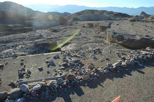
Furnace Creek Wash, Highway 190, completely changed.
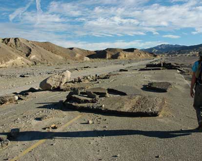
^Pieces of the highway torn out and carried downstream.
The amount of new gravel and rock deposited by one flood was amazing: Highway 190 after a bulldozers uncovered half the road.
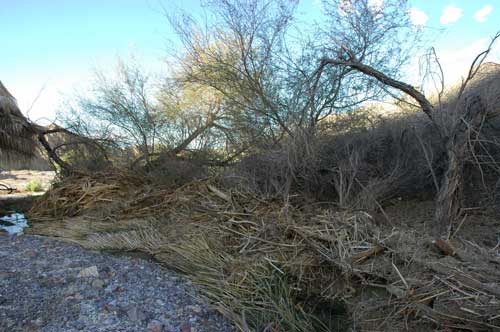
^Debris jam of branches.
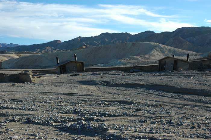
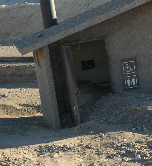
^At Dante's View two restrooms wrenched off their foundations.
^Highway 190 destroyed in Furnace Creek Wash.
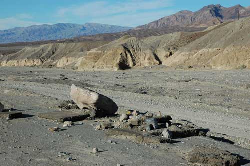
^New boulders deposited on the highway, which is still buried in gravel.
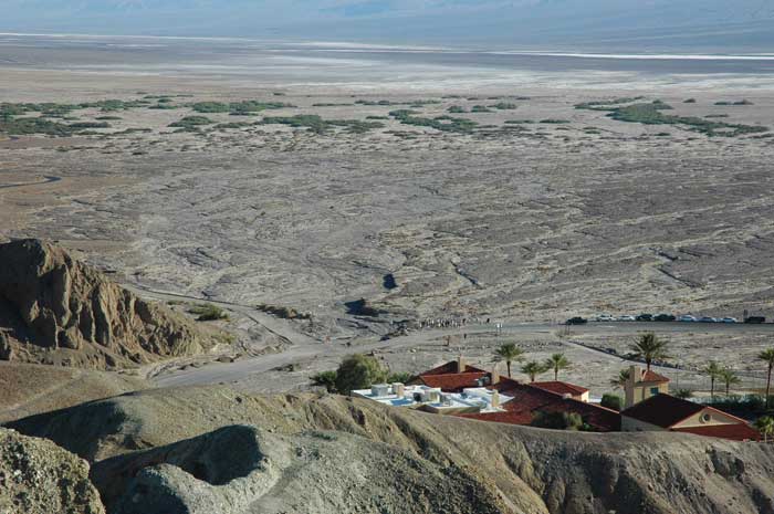
^New rubble and rock spread out over a wide area of the fan next to the Furnace Creek Inn.
REFERENCES:
Redmond, Kelly T. 2009. Historic climate variability in the Mojave Desert. In, The Mojave Desert: Ecosystem Processes and Sustainability. Edited by Robert H. Webb, Lynn F. Fenstermaker, Jill S. Heaton, Debra L. Hughson, Eric V. McDonald, and David M. Miller. University of Nevada Press: Reno and Las Vegas.
Romero-Alvarez, Manuel and Eduardo Zarza. 2007. Concentrating Solar Thermal Power. In, Frank Kreith and D. Yogi Goswami (eds.), Handbook of Energy Efficiency and Renewable Energy. CRC Press: Boca Raton, London, New York.
HOME.....Page 2-Biology.....Page 3-Reliability and Efficiency.....Page 4-Alternatives
Ivanpah Plan of Development.....Last Spring in Ivanpah...?.....Ivanpah Updates